Dodecanese islands lie in the south-eastern Aegean Sea, with Turkey to the east and Crete to the south-west. Outings with a host and longer trips through Greece take place across this island group. Its places include the city of Rhodes, the acropolis of Lindos and the town of Kos. Karpathos, Kalymnos, Leros and Astypalaia join the smaller islands, with their villages, monasteries and harbours. Related reading covers Greek island cruises, Greece island hopping tours and the best Greek islands. More trips appear among Greece tours.
Bookings made through the GetYourGuide widgets on this page earn Classical Greece Tours a commission, at no extra cost to the traveller.
Which are the Dodecanese islands?
The Dodecanese islands are Rhodes, Kos and Patmos, plus 12 other major islands. Those 12 are Karpathos, Kalymnos, Astypalaia, Kasos, Leros, Nisyros, Tilos, Symi, Halki, Leipsoi, Agathonisi and Megisti. In historical terms, Rhodes leads, with Kos and Patmos close behind.
Turkey borders the Dodecanese islands on the east side. Crete lies to their south-west, and the Cyclades lie to their west. The Cyclades form a separate group of Greek islands. The chain also takes in Levitha, Kinaros, Gyali, Farmakonisi, Arkoi and Alimia. Syrna, Saria, Strongyli, Pserimos, Nimos and Marathos complete the list.
Rhodes and Kos had become the leading Dodecanese islands by the early Archaic period. The Archaic period was an early stage in the story of Greece. During the 6th century BC, Dorian Greeks founded Ialyssos, Kameiros and Lindos on Rhodes. The Dorians were one of the main peoples of ancient Greece.
The Ottomans took the islands from the Knights Hospitaller in 1522. The Knights Hospitaller were a Christian order of soldier monks. Rhodes and Kos, the two larger islands, then passed under direct Ottoman rule. The other islands kept wide privileges over taxes and their own self-government. Self-government means that islanders managed their own local matters.
- Regional units: In 2011 the Dodecanese Prefecture, a regional government area, split into four units: Kalymnos, Karpathos-Kasos, Kos and Rhodes.
- Minority: Rhodes and Kos are home to a Turkish Muslim minority within the island group.
- Sweets: Melekouni, a local dessert, appears among the food specialities of the Dodecanese islands.
Hundreds of Eastern Roman churches remain across the Dodecanese islands. The Eastern Roman state is also known as the Byzantine Empire. They stand today in varied states of repair. A state of repair describes how well a building has lasted.
How did the city of Rhodes take shape among the Dodecanese islands?
The Dodecanese islands contain the citadel of Rhodes, which ranks among the best-preserved medieval towns of Europe. The Hospitallers, a Christian order of knights, built this walled citadel. A citadel is a strong walled core built to guard a town.
People have lived on Rhodes, in the Dodecanese islands, since about 4000 BC. That date falls within the Neolithic period, or New Stone Age. The Romans later borrowed the maritime law of the Rhodians. Maritime law is the body of rules for ships, cargo and sailors at sea. Rome then applied those Rhodian rules to its own shipping.
The Apostle Paul called at Rhodes near the close of his third missionary journey. An apostle was one of the first teachers sent out to spread Christianity. A missionary journey was a long trip made to preach that faith. After 1204, a local noble named Leo Gabalas took charge of the island.
Under Ottoman rule, the Knights-era houses of Rhodes gained two typical additions. The first was a bath, placed as a rule at the back of the building. The second was an enclosed wooden balcony fixed to the façade. A façade is the outer front wall of a building. These closed balconies hung over the narrow streets of the town.
- Main city: Rhodes is the principal city on the island of Rhodes, one of the Dodecanese islands.
- Ports: Kolona handles traffic within the Dodecanese islands, Central serves cruise ships, and Akandia takes cargo.
- Modern role: The city was capital of the former Dodecanese Prefecture and now hosts South Aegean regional offices.
In 1309, Pope Clement V confirmed that the island of Rhodes belonged to the Hospitallers. The pope leads the Roman Catholic Church. The Hospitallers formed a religious order whose members lived as monks and also fought as knights.
What stands on the acropolis of Lindos in the Dodecanese islands?
The Dodecanese islands hold Lindos, a town on Rhodes, where Athena Lindia has a temple on the acropolis. Inside it lie an offering table, plus the base for Athena’s cult statue. A cult statue was the sacred image a temple housed.
On the Dodecanese islands, the Propylaea of the Lindos sanctuary dates from the 4th century BC. A propylaea is a grand gateway that leads into a holy area. From the 2nd century BC comes the Hellenistic staircase up to the main archaeological area. The Hellenistic age is the period of Greek culture after Alexander the Great.
A Hellenistic wall rings this acropolis of the Dodecanese islands and shares the age of the Propylaea. An acropolis is a raised stronghold that crowns an old Greek city. In the 14th century, the Knights of St John raised a large fortress on the hill. Their castle partly covered the older buildings of the temple area.
On the south side of the Lindos castle stood a pentagonal tower. Pentagonal means having five sides. This tower commanded the harbour and the settlement of Lindos. It also commanded the road that led in from the south of Rhodes. To command a place means to control it from a strong, high position.
- Towers today: One tower at the south-west corner and another on the west side still survive.
- Church leader: Patriarch Joannicius II of Constantinople, a senior Orthodox bishop, appears among the notable people of Lindos.
- Modern figure: Ioannis Zigdis (1913–1997), a politician and economist, also ranks among the town’s notable people.
Among the Dodecanese islands, Lindos keeps a castle whose walls and towers follow the line of the cliff. The edge of the rock thus sets the course of each stretch of wall. A cliff is a high, steep face of rock.
When did Kos town become the island capital in the Dodecanese islands?
The Dodecanese islands saw the town of Kos become the capital of Kos island in 366 BC. The capital moved there from Astypalaea, near modern Kefalos. The new town was laid out on a Hippodamian grid of straight, crossing streets.
Kos, one of the Dodecanese islands, has the town of Kos as its principal town. It is also where the municipality of Kos has its seat. A municipality is a local authority led by an elected council. The seat is the town where that council meets and does its daily work.
The ancient market place of Kos ranked among the biggest of the ancient world. It stretched from the northern part of the city south to the Decumanus road. The Decumanus was the central road that ran through the ancient city. A market place, or agora, was the busy trading heart of an ancient Greek town.
The market building was enlarged toward its inner yard early in the 2nd century BC. A yard here means the open court in the middle of the building. Archaeologists later brought to light coins, treasures and copper statues from Roman times. Archaeologists study bygone ages through the remains that people left behind.
- Shops: Shops lined the eastern side of the ancient market in this town of the Dodecanese islands.
- Harbour fortress: The Knights Hospitaller raised the fortress at the harbour entrance of Kos in 1315.
- Hippocrates: The town holds the International Hippocratic Foundation of Kos and a Hippocratic Museum.
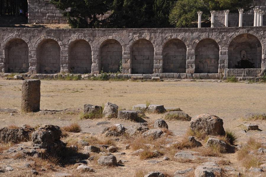
Near that institute on Kos, one of the Dodecanese islands, lie the ruins of the Asklepieion. There, Herodicus taught the art of medicine to Hippocrates, a physician of ancient Greece. An asklepieion was a healing temple of Asclepius, the Greek god of medicine.
Which rulers held Karpathos within the Dodecanese islands?
The Dodecanese islands saw Karpathos lose its independence to Rhodes in 400 BCE. Earlier, in 431 BCE, the Karpathians had taken the side of Sparta during the Peloponnesian War. In that long conflict, the side of Athens fought the side of Sparta.
Among the Dodecanese islands, Karpathos and the smaller Saria together make up the municipality of Karpathos. Each such municipality has a single council for local affairs. In Latin, the island has also gone by the name Carpathus. In Italian, it has been called Scàrpanto. Latin was the speech of the ancient Romans and their empire.
The cities of Karpathos are named in the Delian League’s lists of tribute. That league joined Greek city-states in an alliance under the lead of Athens. In 1304 the island went as a fief, a granted holding, to Genoese corsairs, or sea raiders. By 1306 the island had passed to Andrea Cornaro, from the Venetian Cornaro family.
Karpathos rebelled between 1821 and 1822, in the Greek War of Independence. After that rising, this part of the Dodecanese islands came under Ottoman rule once more. The Greek War of Independence was the struggle of Greeks to win freedom from Ottoman rule. To rebel is to rise openly against those in power.
- Central villages: The villages of Mesochori and Spoa lie in the central part of Karpathos.
- Around the capital: Aperi, Volada, Othos, Pyles, Finiki, Arkasa and Menetes ring the island’s capital.
- Returning families: Karpathos has a large Greek-American community whose members have returned and invested heavily.
In both ancient and medieval times, Karpathos stayed closely connected with its neighbour Rhodes. Medieval times are the long centuries that separate antiquity from the modern era. Both islands belong today to the Dodecanese islands of modern Greece.
Which trade carried Kalymnos beyond the Dodecanese islands?
The Dodecanese islands include Kalymnos, whose people harvested sponges as far away as North Africa. Closer to home, they gathered sponges from the seabed near the islet of Pserimos. A sponge is a simple sea creature with a soft body full of holes.
In 2021, the island of Kalymnos was home to 17,752 people. Among the Dodecanese islands, only Kos and Rhodes had more people. The municipality also covers Pserimos, Telendos, Kalolimnos and Pláti, smaller islands with people living on them. With them, its land area comes to 134.544 square kilometres.
Among the Dodecanese islands, Kalymnos keeps a compact bank of volcanic tuff in its valleys. This bank remains from an ancient volcano. Tuff is a rock made from hardened volcanic ash. Compact means tightly packed and solid. The bank lies at Vigles, a spot between the villages of Kantouni and Myrties.
Only 18% of the land on Kalymnos can be farmed. Farming has therefore played a minor role in the island’s economy. Olives, oranges and vines grow in two fertile valleys, Vathys and Pothia. A vine is a climbing plant whose fruit is the grape. Fertile soil is ground rich enough for good crops.
- Venetian base: During the 13th century, the Venetian Republic used Kalymnos, in the Dodecanese islands, as a naval base.
- Church district: The Orthodox Metropolis of Leros, Kalymnos and Astypalaia, a church district, includes the island.
- By hand: On Kalymnos, sponges are still fished one at a time, by hand.
Darwin and Melbourne in Australia hold large Greek communities of Kalymnian descent. So do Gary in Indiana and Campbell in Ohio, in the United States. Descent here means family roots on Kalymnos, carried abroad by emigrants. An emigrant is a person who settles abroad.
Which towns and songs belong to Leros in the Dodecanese islands?
The Dodecanese islands include Leros, whose largest town and administrative centre is called Agia Marina. At the 2021 census, Agia Marina had 2,380 inhabitants. An administrative centre is the town that holds the main offices of local government.
Other sizable towns of Leros are Lakki, Xirokampos, Kamara and Alinda. Lakki had 2,093 people, ahead of Xirokampos with 710. Alinda counted 699 residents, and Kamara counted 673. These towns spread across Leros, one of the Dodecanese islands. Leros is also called Lero, a form taken from the Italian language.
Among the Dodecanese islands, Leros has its own special genre of music, called havas. The plural form of the word is havades. Plural means more than one. A genre is a type or style of art, such as a kind of song. The best known havas on the island is that of Prouzos.
During the Greek Revolution of 1821, Leros was freed from Ottoman rule. The island then became an important base for supplying the ships of the Greek Navy. The Greek Revolution was the armed rising that led to an independent Greek state. To supply a navy is to bring its ships food, water and arms.
- Summer: Leros had 7,992 people in 2021, a figure that passes 15,000 at the summer peak.
- Poet: Demodocus of Leros was a gnomic poet, a writer of short wise sayings, in the sixth century BC.
- Sweet: Patsavouropita, a Leros cake, is made with layers of filo pastry and syrup.
On Leros, in the Dodecanese islands, the Knights of Saint John had a medieval castle. Its builders possibly set it on an older Byzantine fortress. Scholars call the eastern empire of Rome in its later centuries Byzantine. A fortress is a stronghold for defence.
Which ancient traces does Astypalaia keep among the Dodecanese islands?
The Dodecanese islands include Astypalaia, whose town of Chora occupies the ground of the old city-state. Its older houses and its castle reuse worked stones from ancient monuments. Worked stones are blocks that masons once cut and shaped by hand.
Astypalaia, one of the Dodecanese islands, spreads over 97 square kilometres of land. The island was colonised by Megara, or possibly by Epidaurus. Megara and Epidaurus were city-states of mainland Greece. Each city-state governed itself together with its nearby farmland. To colonise means to send settlers to found a new community.
The island’s treaty with Rome formally treated both sides as sovereign equals. Sovereign means holding full power to rule oneself. Each side agreed not to aid the other’s enemies or let them pass through. If either side came under attack, the other promised to come to its aid. A treaty is a binding pact made between states.
At Pera Gialos, beside the old port, a museum of a single room shows finds from the island. Its displays include inscriptions and grave monuments. A grave monument is a stone marker set over a burial. The oldest material there is fragments of Neolithic pottery. The Neolithic is the New Stone Age of human history.
- Offshore islets: Sýrna and Ofidoussa are the largest of the uninhabited islets beside Astypalaia in the Dodecanese islands.
- New harbour: A harbour has newly been built at Agios Andreas, midway along the island.
- Athlete: Kleomedes, a boxer of ancient Greece, came from Astypalaia and was active about 496 to 492 BC.
Inscriptions found on Astypalaia, in the Dodecanese islands, reveal how the ancient island was governed. The same texts also tell of its public buildings. Such inscriptions are lettering carved into stone or other hard material. Governed means run by leaders under a set of laws.
Which villages and harbour does Agathonisi add to the Dodecanese islands?
Dodecanese islands reach their northernmost point at Agathonisi, a small Greek island that is also its own municipality. Between its two villages lies the small settlement of Agios Georgios, or Saint George. That settlement forms the only harbour on Agathonisi.
Both villages of Agathonisi stand inland, away from the coast. Their names are Megalo Chorio, meaning Big Village, and Mikro Chorio, meaning Small Village. Chorio is the Greek word for a village, so each name simply describes its size. On this small corner of the Dodecanese islands, the highest point rises to 209 metres above sea level.
Within the Dodecanese islands, Agathonisi spreads over 13.5 square kilometres. Its rock is almost entirely subcrystalline stratified limestone. Stratified means that the stone lies in clear layers. Subcrystalline means that its crystals are only partly formed. Thorny macchia covers the island. Macchia is a thick scrub of tough, prickly shrubs on dry hillsides.
In the late 1920s, Agathonisi had 80 inhabitants. They worked in agriculture and in sheep rearing. Agriculture means growing crops, and sheep rearing means keeping flocks of sheep. A census is a state tally of residents, taken house by house. By the 2001 census, the population of the island had risen again to 158 residents.
- Census low: At the 1991 count, the population of Agathonisi had fallen to 112 people.
- Northern outpost: Under Italian rule, Agathonisi was the northernmost islet in the Italian Islands of the Aegean.
- Status: In 2011 the Kallikratis Plan, a local government reform, raised the island from community to municipality.
Ancient writers varied in how they recorded the name of Agathonisi. Forms such as Tragia, Tragiai, Tragaea and Tragaia appear in their works. Each of these old names belongs to the small island at the northern tip of the Dodecanese islands.
How do Mandraki and the islet of Gyali shape Nisyros in the Dodecanese islands?
Dodecanese islands include Nisyros, whose main town and port is Mandraki. The island’s other villages are Paloi, Nikia and Emporeios. Tourism there is less heavily developed than on other Greek islands. Nisyros also holds a large number of Orthodox Christian churches.
Near Mandraki stand ancient walls from the 5th century BC. They formed part of the island’s acropolis, a walled citadel on high ground. Mandraki also holds Panagia Spiliani, the largest monastery on Nisyros. Its name means the Blessed Virgin Mary of the cave. It stands beside the castle of the Knights Hospitaller, a crusading religious order.
Across this part of the Dodecanese islands, Nisyros keeps four monasteries. No monks live in any of them today. Celebrations still take place inside their walls. In a monastery, monks share a life of prayer and work. Mandraki is twinned with Lapithos in Cyprus. Twinning is a formal bond of friendship between two towns.
Gyali, a volcanic island of the Dodecanese islands, sits midway between Nisyros and the southern shore of Kos. Its north-eastern part is almost entirely obsidian, while its south-western part is pumice. Obsidian is a dark volcanic glass that forms when lava cools very fast. Pumice is a frothy, airy stone that forms when gassy lava cools.
- Isthmus: A slim isthmus, or neck of land, and a reef-sediment beach join the two halves of Gyali.
- Hideaway: After the 1821 revolution, Andreas Miaoulis used Gyali as a hideaway, and people settled there again.
- Old soils: No eruptions on Gyali are known from recorded history, yet its latest pumice covers New Stone Age pottery.
Within the Dodecanese islands, Gyali seems to have had seasonal settlers from the early 4th millennium BC. The higher lands served mainly in winter for cattle grazing. Where pumice is strip-mined, parts of Gyali are now bare of plants. Strip mining removes the surface rock.
Which old capital and monastery mark Tilos out among the Dodecanese islands?
Dodecanese islands reach Tilos midway between Kos and Rhodes, out in the Aegean Sea. This small Greek island also forms its own municipality within the Rhodes regional unit. At the 2021 count, the island of Tilos was home to 746 people.
The Knights of St John first settled Mikro Chorio, the old capital, in the 15th century. The name translates as Small Village. In 1470 the Knights evacuated this part of the Dodecanese islands. That year the Ottoman army started its siege of Rhodes. In a siege, troops ring a town or fort and cut off its supplies.
On Tilos, the monastery of Agios Panteleimon has fresh, cold water springs. Agios means saint in Greek. An enormous loquat tree also grows at the monastery. A loquat is a fruit tree with small, sweet, orange fruit. Tilos is well supplied by springs, and this part of the Dodecanese islands is potentially very fertile.
In summer 1906, the British scholars A. J. B. Wace and R. M. Dawkins came to Tilos. Their visit came during a broader journey around the region. They published their notes in the hope of helping later travellers. Five rare photographs and a list of sources appear in their article.
- Landscape: Mountains of limestone fill the interior, beside volcanic lowlands, beds of pumice and red lava sand.
- Other names: In Turkish the island has been called İlyaki, and in modern Italian it has been called Piscopi.
- Power: Tilos now meets its own electricity needs from the sun and wind, backed by a battery farm.
In popular tradition, Helios and Halia were the parents of Telos. Helios was the Greek god who personified the sun. Telos reached this corner of the Dodecanese islands to find herbs to cure his sick mother. Later he built a temple to Apollo and Neptune there.
Where do Halki and the bays of Alimia sit within the Dodecanese islands?
Dodecanese islands include Halki, an island of 28 square kilometres. Its 2021 census recorded 475 inhabitants. The Knights of St John once held a castle above the old town, now in ruins. Its chapel keeps original frescoes, or paintings on wet plaster.
Far more people once lived on Halki. Emigration during the mid-20th century then left Chorio almost completely abandoned. To emigrate is to leave a homeland and settle in another country. A solar park on Halki yields 1.8 gigawatt-hours of power annually. A gigawatt-hour is one million kilowatt-hours of electrical energy.
On Halki, rainfall is collected in large cisterns. A cistern is a tank or chamber that stores water. Drinking water for this part of the Dodecanese islands is brought in from Rhodes. By 2014, a desalination plant stood on the island. Desalination removes salt from seawater so that people can drink it.
Alimia lies in the sea between Rhodes and Halki, within the Dodecanese islands. Its surface covers 7.4 square kilometres, with a coastline of 21 kilometres. Its two main bays, Emporio in the east and Saint George in the west, are safe natural harbours. A natural harbour is a bay sheltered from waves by the land itself.
- Dockyards: Dockyards carved into the rock date from the Hellenistic period, when Alimia belonged to the Rhodian state.
- Fleet base: The Rhodian fleet used the fortified island as an observatory and as an anchorage, a mooring for ships.
- Emporio finds: On the coast of Emporio lie Roman tombs, ancient walls and the base of an early Christian basilica.
The Hellenistic castle of Alimia survives on the highest peak in the east of the island. Hellenistic describes the Greek world in the centuries following Alexander’s death. In recent decades, this corner of the Dodecanese islands has stayed uninhabited.
What do Fri, Poli and early travellers reveal about Kasos in the Dodecanese islands?
Dodecanese islands include Kasos, a Greek island municipality within the regional unit of Karpathos-Kasos. Fri is its capital and holds the harbour of the island. Agia Marina has the largest population of its villages. As of 2021, Kasos had 1,223 people.
The main island of Kasos spans 49 square kilometres. From end to end it runs 17 kilometres, and its broadest point measures 6 kilometres. Its shape is elliptic, like a stretched oval, and resembles the outline of Rhodes. Fresh water is also found on this part of the Dodecanese islands.
Bernard Randolph, an English merchant, wrote about the island in 1687. He described it as small, yet rich in all things needed for life. He wrote that its centre was almost a plain. Olive trees, vineyards and every kind of fruit grew there. A merchant is someone who makes a living from trade.
On Kasos in the Dodecanese islands, the acropolis of Poli dates from the Bronze Age and later. Only traces of its early defensive walls remain. Its cemeteries held burials with inscribed lenticular discs, chiefly from the 3rd and 4th centuries BC. Lenticular means shaped like a lens. An acropolis is the fortified high ground of a town.
- Islets: The municipality also holds uninhabited islands, the largest of them Armathia and Makronisi.
- Old name: The English travel writer Robert Liddell noted that Phry, a form of Fri, is short for Ophrys.
- Wine and honey: The French naturalist Charles Sigisbert Sonnini praised the island’s very good wine and its honey.
The Kasos Archaeological Museum stands in the original demarcheion of Fri. A demarcheion is a Greek town hall. Its displays cover every period of island history, from prehistoric to early Christian times. Folklore and local history also have a place in this museum of the Dodecanese islands.
What made the harbour town of Kastellorizo stand out among the Dodecanese islands?
Dodecanese islands include Kastellorizo, where an estimated 9,000 people lived at the 1908 peak. At that time its port was still the only safe harbour on the route between Makri and Beirut. Makri is the town now called Fethiye.
The Knights Hospitaller restored the castle on this part of the Dodecanese islands. Later the castle served as a jail for knights who disobeyed orders. Their order joined religious vows with military service. In 1461, Alfonso V of Aragon rebuilt the castle. He then sent a Catalan governor. Catalan means from Catalonia, in north-eastern Spain.
The geology of Kastellorizo is almost entirely limestone. Little plant cover grows there, so the landscape shows features of karstification. Karstification is the slow dissolving of limestone by rainwater, which leaves caves and hollows. In 2006, cavers explored vertical caves across the island. Surveyors measured the deepest one found so far at 60 metres.
Charcoal production once flourished on Kastellorizo. Buyers in Alexandria sought the charcoal for narghile pipes. A narghile is a water pipe, in which smoke passes through water before it is drawn. In the late 1920s, the town on this outpost of the Dodecanese islands had 730 inhabited houses. Another 675 houses already stood empty.
- Water of silence: Girls once fetched Amilito Nero, the water of silence, which was believed to bring the family good luck.
- Island life: Despina Achladiotou, born on Kastellorizo around 1890, sailed to the deserted island of Ro in 1927.
- Daily flag: Known as the Lady of Ro, she raised the Greek flag over Ro every day until her death.
A Greek army unit is now stationed on Ro. Its main duty is to keep up her tradition of raising the flag. Ro belongs to the small archipelago around Kastellorizo, within the Dodecanese islands. Archipelago is the word for a scatter of neighbouring islands.
What do travellers ask about Dodecanese islands, and what are the answers?
Dodecanese islands passed by formal annexation to Fascist Italy in 1923. In Italian, their title was Possedimenti Italiani dell’Egeo, or the Aegean Possessions of Italy. Kastellorizo followed a separate path. France occupied it in 1915, and it came under Italian control in 1921.
Why did the Dodecanese islands not join Greece after the First World War?
After the First World War, Italy twice agreed to give the islands to Greece. These were the 1919 Venizelos–Tittoni agreement and the 1920 Treaty of Sèvres. Rhodes was the exception, with extensive autonomy, or self-rule. After Greece lost its 1919–22 war with Turkey, neither deal was implemented.
How did Italian rule approach religion on the Dodecanese islands?
Religion was the one field where Governor Mario Lago gave no ground. Italian authorities sought to create an autocephalous church for the Dodecanese. Autocephalous means self-governing, with its own head rather than an outside church leader. The goal was to curb the influence of the Greek Orthodox Church. The attempt did not succeed.
How did Italian rule touch the smaller Dodecanese islands?
The Italians started mass-scale tourism on Rhodes and Kos. The smaller islands, by contrast, were mostly left out of the improvement work. They remained underdeveloped as a result. On Rhodes and Kos, Italian settlers were farmers who set up new agricultural settlements. An agricultural settlement is a planned farming village with fields around it.
How was local government run on the Dodecanese islands under Italy?
From 1923, civil governors took the place of the military commanders. A civil governor is an official from outside the army. Lago also let the inhabitants elect their own mayors. In 1938, a newly appointed podestà ran each municipality. A podestà was a town head named by the state, not by voters.
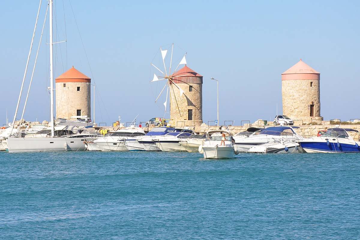
Featured photo: File:Medieval windmills (9451874269).jpg | Jorge Láscar from Australia, CC BY 2.0, via Wikimedia Commons.