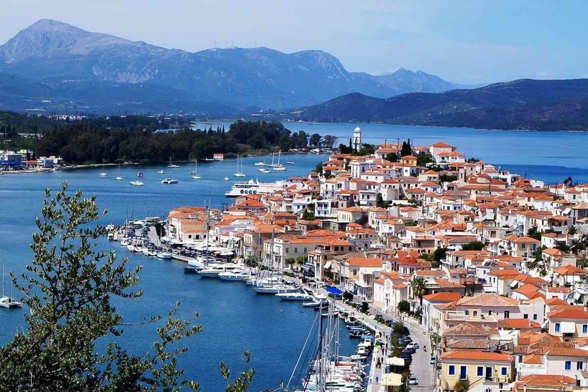
Greek islands near Athens draw expert-led and small-group trips through the Saronic Gulf and the waters off Attica. Such trips link islands that lie close to the Greek capital. Salamis holds the Cave of Euripides, and Makronisos lies off the Attica coast. Kea keeps ancient Carthaea, while Kythnos has Vryokastro, Dryopida and Katafyki Cave. Euboea adds Amarynthos, Steni Dirfyos and Avlonari. Longer plans sit in Greece island hopping tours and the 10 day Greece itinerary. More trips appear under Greece tours.
Bookings made through the GetYourGuide widgets on this page earn Classical Greece Tours a commission, at no extra cost to the traveller.
Which are the Greek islands near Athens?
The Greek islands near Athens start with the Islands regional unit, a part of the region of Attica. This kind of unit is a slice of local government within a wider region. Attica wraps around Athens, the Greek capital, on the mainland.
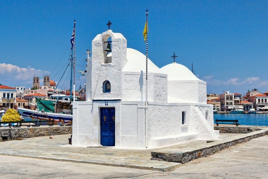
The name of the Saronic Islands comes from the Saronic Gulf, the sea where they lie. The gulf itself is wide water partly ringed by land. The four main islands with residents in this group are Salamis, Aegina, Agistri and Poros. Within the Greek islands near Athens, these four lie in the Saronic Gulf itself.
The unit has 8 municipalities, or local councils: Salamis, Aegina, Poros, Agistri, Hydra, Spetses, Kythira and Troizinia-Methana. A council of this kind runs local affairs for a town and its villages. Aegina, Agistri, Poros and Salamis came under the Attica and Boeotia Prefecture, set up in 1833. A prefecture was an older type of regional district.
Kea-Kythnos stands as a separate regional unit, under the South Aegean. It covers Kea, Kythnos and Makronisos, plus smaller Aegean islands. This sea lies between the Greek mainland and Turkey, as part of the Mediterranean. Among the Greek islands near Athens, Kea, Kythnos and Makronisos form this South Aegean unit.
- Coverage: Its land spans the Saronic Islands, a small area of the Peloponnese and islands by that coast.
- Older link: Hydra, Kythira, Spetses and Troizinia-Methana sat in the Argolis and Korinthos prefecture until 1929.
- Euboea: The Euboea regional unit holds Euboea, Skyros and 260 square kilometres of mainland.
The 2011 Kallikratis reform of local government created the Kea-Kythnos unit. The new unit was carved from part of the former Cyclades Prefecture. The Cyclades are an island group in the central Aegean. For the Greek islands near Athens, Kea and Kythnos gained their own unit.
What does Salamis bring to the Greek islands near Athens from Kynosoura to Aianteio?
The Greek islands near Athens include Salamis and its peninsula of Kynosoura, a name that means dog’s tail. The name seems to come from its long, thin shape with a pointed end. A peninsula is a spur of ground jutting into open water.
In the north of Kynosoura lie the remains of an ancient tumulus. A tumulus is an earth mound raised over a burial. Experts think it holds Greek warriors who fell in the Battle of Salamis. Xeno, in the north-west corner of the island, means foreign, as its first settlers came from Piraeus.
Among the Greek islands near Athens, Salamis holds Aianteio, a village named after Ajax. In Homer’s Iliad, an ancient Greek poem, Ajax leads the men of Salamis. The village carried the name Moulki until 1915. The area also has Saint John the Kalyvitis, the oldest church on the island, from the 10th century.
Islanders who live inland mainly work in farming. The majority of people on Salamis, though, work in jobs linked to the sea. These include fishing, ferry work and the island’s shipyards, where ships are built and repaired. Other residents of this island among the Greek islands near Athens commute to work in Athens.
- Arvanites: Records from 1688 list Arvanites, a people speaking a form of Albanian, among the islanders.
- Kulluri: In Arvanitika, the language of the Arvanites, the island goes by the name Kulluri.
- Grave of a hero: Greek War of Independence fighter Georgios Karaiskakis, honoured as a hero, lies buried on Salamis.
Salamis has a hot semi-arid climate, a dry type with little rain. Its winters are mild and its summers very hot. A weather station of the National Observatory of Athens supplies this record. Salamis counts among the Greek islands near Athens.
Why is the Cave of Euripides a landmark of the Greek islands near Athens on Salamis?
The Greek islands near Athens include Salamis, home to the Cave of Euripides. Since ancient times, people have known it as the place where Euripides wrote his tragedies. Euripides was an ancient playwright, and a tragedy is a solemn drama that ends in sorrow.
The cave is narrow and runs about 47 metres deep. Inside, it splits into ten small chambers, or rooms. It sits on a hillside above the Saronic Gulf, the sea between Attica and the Peloponnese. The site lies at Peristeria, on the south coast of Salamis, among the Greek islands near Athens.
Two ancient writers, Philochorus and Satyrus, called Euripides a misanthrope. A misanthrope is a person who dislikes other people and avoids company. In their account, he kept away from society by hiding in a cave. Aulus Gellius, a Roman author of the second century, claimed to have visited the gloomy cavern himself.
Yannos G. Lolos led excavations at this cave of the Greek islands near Athens in the 1990s. Excavation means digging with care to bring old remains to light. Lolos taught prehistoric archaeology, the study of people before writing, at the University of Ioannina. The Greek Ministry of Culture joined through its palaeoanthropology team, which studies early humans.
- Inscribed cup: A broken skyphos, a drinking cup, from the late 5th century BC bears part of Euripides’ name.
- Offering: Lolos read the cup as a votive offering, a gift to honour Euripides.
- Shrine of Dionysus: About 70 metres southwest, Lolos uncovered a small country shrine that he linked to Dionysus.
Finds at the cave date from the late Neolithic, the final stage of the Stone Age, onward. They include stone tools, arrowheads and Mycenaean, or Late Bronze Age, burials. Roman coins also turned up inside this Salamis cave, among the Greek islands near Athens.
Among the Greek islands near Athens, what past does Makronisos carry?
The Greek islands near Athens include Makronisos, a name that means Long Island in Greek. It sits close to the shore of Attica, the mainland region of the capital. The island faces the port of Lavrio, a mainland harbour town on that coast.
Makronisos is long and narrow in shape. Its length, measured north to south, is 13 km. At its widest point, the width reaches 2.5 km. The ground is arid, meaning very dry, and rocky. It is the largest Greek island with no residents. Among the Greek islands near Athens, it stays empty of people.
In ancient times, people called this long strip of the Greek islands near Athens Helene. Two ancient writers, Strabo and Pausanias, both traced this name to Helen of Troy. In Greek legend, Helen was the wife of Menelaus. Pausanias suggested that Helen landed there after the capture of Troy.
Among the Greek islands near Athens, Makronisos took in Greek refugees from the Ottoman Empire after 1922. The Ottoman Empire was the Turkish state that once ruled lands around the Aegean. On the island, a quarantine station was set up to slow smallpox and typhus. Quarantine means keeping people apart so that a disease cannot pass between them.
- Old harbours: In antiquity the island shielded the harbours of Thorikos and Sounion on the Attica coast.
- Prison site: From the 1920s to the 1970s, the island held a political prison.
- Protected monument: The island and its original buildings are protected as a monument of the Greek Civil War era.
In 1922 and 1923, a total of 12,295 refugees went through Makronisos. The majority were women and children, and elderly people also came. Elderly people are those in old age. A refugee is someone forced to leave home to find safety in another place.
Which ruins make Carthaea a highlight of the Greek islands near Athens on Kea?
The Greek islands near Athens include Kea, known in ancient times as Ceos. Carthaea was one of the four city-states of that island, on its south-eastern coast. A city-state was a self-ruling town together with its surrounding farmland.
Carthaea had residents from the 8th century BC right up to the 6th century AD. The earlier date falls in the Geometric period, named after the patterns on its pottery. In 1811 the Danish scholar Brøndsted dug at the site with thirty local workers. He was seeking ancient Greek artefacts.
At this site among the Greek islands near Athens, builders made two terraces. They lie on the lowest part of the acropolis, a city’s fortified hilltop. The terraces gave room for temples and public buildings. On the upper one stood Building D, with a porch of four Doric columns. Doric is the plainest style of Greek column.
Inside Building D, the cella, or main room, was almost square. Its floor was a mosaic, a design made from small stones set close together. White sea pebbles covered three sides. A square of purple volcanic stones formed the centre, with a cube-shaped limestone base. This building stood on Kea, one of the Greek islands near Athens.
- Public notices: The city’s decrees, or official decisions, went on display on the terrace before Apollo’s temple.
- Rock-cut stairs: Late Archaic stairs, partly carved into bedrock, led to a path joining the two plateaus.
- Reused stone: An Early Christian basilica, a church hall, reuses stone from a temple attributed to Demeter.
Carthaea’s ancient cemetery lies outside the city wall. It sits in the valley of the Kalamitsis on Kea. A cemetery is a field set aside for graves. Among the Greek islands near Athens, Kea holds this burial ground.
Within the Greek islands near Athens, how did Vryokastro serve as a capital?
The Greek islands near Athens include Kythnos, home to the archaeological site of Vryokastro. Such a site is a place where remains of past people are dug up and studied. Vryokastro is considered the ancient capital of the island of Kythnos.
In ancient times the town itself carried the name Kythnos. The island took its name from the town. People lived at this spot among the Greek islands near Athens from the 12th century BC. They stayed until the Early Middle Ages, the centuries after Roman rule ended in the west.
Vryokastro sits in the north-west of Kythnos. It lies between two bays, Merichas and Apokrisi. A bay is an inlet where water curls into the land. The ancient town spread over 300 acres, and city walls ran around it. An acre is an old English unit for measuring land.
From 2000 to 2016, archaeologists dug an unplundered sanctuary on this part of the Greek islands near Athens. Unplundered means that robbers had never stripped it. A sanctuary is ground made sacred to the gods. Its temple stood intact, and every offering still lay in its original place. An offering is a gift to a god.
- Town remains: Digs have found public buildings, an aqueduct for water, an acropolis, two cemeteries and a harbour.
- Town hall: A two-storey building is believed to have been the prytaneum, the seat of the city’s leaders.
- Church: On Vryokastraki, digs found the first Early Christian basilica church with three aisles known on Kythnos.
The present-day rocky islet of Vryokastraki was once part of the town. At that time, land linked it to the rest of Vryokastro. Islet is the term for a pocket-sized island. Vryokastraki lies off Kythnos, one of the Greek islands near Athens.
What gives Dryopida its place among the Greek islands near Athens on Kythnos?
The Greek islands near Athens include Kythnos, where Dryopida is both a village and a local community. Its architecture has earned it official status as a traditional settlement. That title marks a village officially valued for its old style of building.
The name Dryopida is thought to come from the Dryopes, the first people on Kythnos. The village was first called Syllakas, or Chorio, the Greek word for village. Locals still use the old names, and the villagers are called Syllakotes. Dryopida was also an ancient name for Kythnos itself.
Dryopida lies in the southern part of Kythnos, about 7 kilometres from Chora. Chora is the name islanders give to the chief town of their island. The village sits between two hills of Kythnos, among the Greek islands near Athens. It stands at an elevation of 190 metres, measured upward from the sea.
The main mark of Dryopida is its tiled roofs of ceramic, which is baked clay. Tiles are thin pieces laid in overlapping rows. The custom goes back to the jobs of local people. They worked as tilers and roofers in Athens. On returning, they brought this roofing custom to their home among the Greek islands near Athens.
- Residents: The 2021 census counted an estimated 854 people in the Dryopida community.
- Early mention: French Jesuits, Catholic priests on missions, wrote about Dryopida in 1700 during Aegean journeys.
- Folklore Museum: The Kythnos Folklore Museum in Dryopida shows costumes, tools and objects from daily life.
The church of Saint Minas in Dryopida has a wood-carved iconostasis. An iconostasis is a screen of holy pictures that stands before the altar. It also keeps old icons, painted images of saints. This village church belongs to Kythnos, among the Greek islands near Athens.
Across the Greek islands near Athens, where does Katafyki Cave fit?
The Greek islands near Athens include Kythnos, where Katafyki Cave lies in the village of Dryopida. The cave takes its name from serving as a shelter in different periods. A shelter is a place where people find cover from danger or bad weather.
Surveys have mapped over 600 metres of the natural cave. A survey here means careful measuring to draw an accurate plan. Experts estimate that the passageways cover 3500 square metres. A passageway is a narrow way through the rock. This cave lies on Kythnos, among the Greek islands near Athens.
Katafyki, among the Greek islands near Athens, once worked as an iron mine. Hematite, a reddish iron ore, was the main mineral dug out. Mining also added a man-made gallery 2000 metres long. A gallery is a tunnel cut by miners to reach the ore. Ore is rock that holds a useful metal.
Inside the entrance lies a flat area called the small plateau. Further in comes the large plateau, known as the piazza, an Italian word for square. In the large piazza, the people of Dryopida held religious festivals. These took place after the Resurrection at Easter, the Christian feast of the risen Christ.
- Stalactite hall: Two corridors lead to the stalactite hall, which measures 25 by 17 metres.
- Named shapes: Stalactites, stone spikes hanging from the roof, bear names such as jellyfish, octopus and teddy bear.
- Second name: The cave is also called Giorgos Martinos Cave, after the geologist, a rock scientist, who studied it.
Iron mining at the cave in modern times ran from 1835 to 1940. After 1910, foreign companies took over the digging of the ore. That work went on at Dryopida, a Kythnos village among the Greek islands near Athens.
Which story does Amarynthos add to the Greek islands near Athens on Euboea?
The Greek islands near Athens include Euboea, where Amarynthos is a coastal town, also called Vathia. A coastal town is one built along the shore. Since 2011 the town has been a municipal unit, a local district, of the Eretria municipality.
A number of scientists place the Eretria of the Mycenaean period on the site of present Amarynthos. The Mycenaean period was the late Bronze Age in Greece. Finds point to a permanent settlement here since the Late Neolithic, around 3000 BC. In the Early Bronze Age, the place was a significant port of Euboea.
The name Amarynthos appears on clay tablets inscribed in the Linear B script. Linear B is an early system of signs used to write Greek. Besides trade, the people here farmed, kept herds and fished. They also processed copper, a reddish metal, at this Euboea site among the Greek islands near Athens.
In Greek mythology, Amarynthos was a man from Eretria. He kept running after the goddess Artemis because he loved her. The town on Euboea, among the Greek islands near Athens, received his name. Artemis was the goddess of hunting and wild animals in Greek myth. Mythology means old stories about gods and heroes.
- Position: Amarynthos stands 8 km east of Eretria and 27 km southeast of Chalcis.
- Mountain: The Euboean Olympus, a mountain 10 km to the north, overlooks the town.
- Monastery: Northeast of the town, the Byzantine monastery of Agios Nikolaos keeps wall paintings from the 12th century.
Refugees from Asia Minor reached Euboea, one of the Greek islands near Athens, after the Greco-Turkish War. A large share of them settled in Amarynthos and boosted its population. Asia Minor is the large Asian landmass of modern Turkey.
How do the Greek islands near Athens gain a mountain village in Steni Dirfyos?
The Greek islands near Athens include Euboea, where Steni Dirfyos lies near the island’s centre. Its old name was Ano Steni. In Greek, ano means upper, and steni means narrow. Dirfyos means of Dirfys, the name of the mountain there.
Steni stands 30 km northeast of Chalcis, the main city of Euboea. It lies at a height of 440 metres on the slopes of Mount Dirfys. A slope is ground that tilts up toward a peak. Steni forms part of the Dirfys-Messapia municipality and serves as seat of the Dirfys unit.
Settlers from Skounteri built Steni, on one of the Greek islands near Athens, in about 1790. Today Skounteri is called Pyrgos. Under Ottoman rule, Skounteri was the seat of the local Ottoman governor, known as the Bey. A governor is a ruler’s appointed head of a district. Skounteri then emptied of almost all its people.
A big steep rock named Kleisoura rises close to Steni. In the Ottoman period, it served as a refuge for local Klephts. A refuge is a hidden place of safety. Klephts were local fighters who rose against Ottoman rule. Klephts found cover in these Euboea heights among the Greek islands near Athens.
- Climbers: In recent years, climbers and mountain walkers have made the village a popular stop.
- Paths: Hiking paths run from the village toward the mountain refuges, which are simple huts.
- Frescoes: Five 16th-century wall paintings, or frescoes, from the Byzantine church of Palaiopanagia were stolen in 1978, then returned.
After Greek independence, Steni became the leading village of mountainous central Euboea. Independence here means freedom from Ottoman rule. Central Euboea is the hilly middle part of the island. Euboea is one of the Greek islands near Athens.
Among Greek islands near Athens, what medieval past does Avlonari bring?
The Greek islands near Athens include Euboea, and Avlonari is a village in the east of the island. It forms a community, or local unit, of the municipality of Kymi-Aliveri. A municipality is a council area that groups towns and villages.
Within the Greek islands near Athens, Avlonari was once the seat of Avlon municipality. During the Middle Ages, the place was the town and bishopric of Aulon. A bishopric is the district that a bishop, a senior church leader, oversees. Records name Aulon as a town and bishopric from the 9th century onward.
Below Avlonari, in the low ground, stands the Byzantine church of St. Demetrios at Chania. Its builders reused material from an earlier church. Byzantine means from the era of the Eastern Roman Empire. After the Fourth Crusade, Crusaders split Euboea and set up Lombard baronies. These were estates held by lords from Lombardy in northern Italy.
In the 15th century, Venice ruled this corner of the Greek islands near Athens as a district. Two captains led the district. They had their seats in fortresses on the nearby heights of Cuppa and Potiri. A fortress is a walled base for soldiers. Their Latin title was Capitanei Avalone, meaning captains of Avlon.
- Villages: The Avlonari community also takes in the villages of Chania, Dafni, Elaia and Lofiskos.
- Setting: Avlonari sits on a hillside, 13 km northeast of Aliveri and 15 km south of Kymi.
- Watch tower: A watch tower of three storeys still survives in Avlonari itself.
The Castle of Cuppa is a medieval fortress in the centre of Euboea. It stands on Mount Mavrovouni, southwest of the village of Vrysi. Medieval means from the Middle Ages. Euboea, home to this fortress, ranks among the Greek islands near Athens.
What do travellers ask about Greek islands near Athens, and what are the answers?
The Greek islands near Athens include Coressia, the ancient harbour town of Iulis on Kea. Merichas is the main port of Kythnos. Petalioi is a cluster of islets off Euboea. Patroklos is a small private island in the Saronic Gulf.
Among the Greek islands near Athens, what was ancient Coressia on Kea?
Near Coressia stood a temple of Apollo Smintheus. Smintheus is a title of Apollo tied to mice in ancient Greek belief. A small stream named the Elixus flowed past the town into the sea. The site lies close to modern Livadi. In 1922 Livadi took the new name Korisia.
How did Merichas, a port on the Greek islands near Athens, get its name?
The name Merichas can be traced back to the myrrh plant. Myrrh is a sweet-smelling resin, a sticky gum, from a small tree. In the 16th century, the Greek seaman Antonio da Millo mentioned the bay. He was also a cartographer, or map maker, and he called the bay Merza.
What makes up the Petalioi group among the Greek islands near Athens?
The Petalioi group holds ten small islands and islets, and almost all of them are uninhabited. Islets are tiny islands, and uninhabited means empty of residents. The group takes its name from Petalios. In ancient times, Petalios was the name of Megalonisos, the largest island of the complex.
Why did pirates favour Patroklos among the Greek islands near Athens?
In the late Middle Ages, Patroklos had a bad name as a haven for pirates. A haven is a safe place to hide, and pirates are robbers at sea. In December 1437, Catalan pirates nearly captured the Byzantine emperor John VIII Palaiologos there. Catalans come from Catalonia, in the north-east of Spain.