
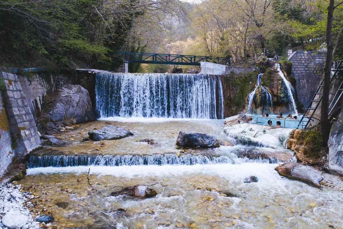
Waterfalls in Greece give a theme to small-group trips across the mainland and the islands. Falls, gorges and rivers shape the land from Macedonia and Epirus to Thessaly, the Peloponnese and Crete. Topics run from Edessa Falls and Balta of Striga to the Gorgopotamos, the Pineios and the Strymonas. Later parts turn to the springs of the Peloponnese, the islands and the gorges of Crete. Close cousins of these trips are Greece hiking tours, national parks in Greece and Pelion tours. Each one sits within the broad range of Greece tours.
Bookings made through the GetYourGuide widgets on this page earn Classical Greece Tours a commission, at no extra cost to the traveller.
Which are the waterfalls in Greece?
The waterfalls in Greece named on the world list of waterfalls come to three in all. They are Edessa Falls, Lepida Gorge and Balta of Striga. In any waterfall, river or stream water spills over a sheer drop or steep steps.
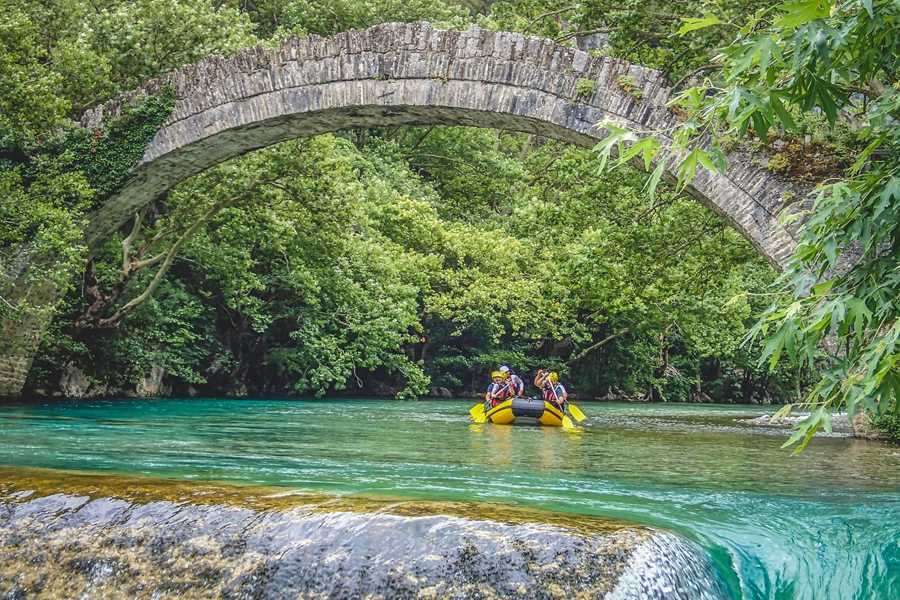
Edessa Falls in Macedonia stands 70 metres high. Lepida Gorge in the Peloponnese joins the waterfalls in Greece on that list at 45 metres. A gorge is a deep, tight valley walled by steep rock. The list gives each height in metres and in feet. On that scale, Edessa Falls measures 230 feet.
Waterfalls in Greece and elsewhere also go by two other English names, cascade and cataract. By one usage, a cataract is a larger, stronger fall and a cascade a smaller one. Natural falls commonly form high on a river, where lakes run into steep mountain valleys. Earthquakes, landslides and volcanoes can also create falls by moving the ground.
At the foot of a fall lies a plunge pool, a pool that forms where the water lands. Each fall also makes a microclimate, the local weather of one small spot. Close to a fall, the air is cooler and more humid than the land around. Ephemeral, or short-lived, falls run only after rain or a large snowmelt.
- Old interest: Humans have travelled to see, explore and give names to falls since prehistory.
- Modern interest: Since the 18th century, falls have drawn notice as tourist places and as sources of hydropower.
- River traffic: Falls can form serious barriers to navigation, or travel by boat, along rivers.
Balta of Striga in Epirus completes the waterfalls in Greece on the list, at 25 metres. By the common definition, a waterfall stands at least five feet high. Other sources set the minimum height higher, at 20 feet.
What gives Edessa its place among the waterfalls in Greece?
The waterfalls in Greece at Edessa lie within the city limits, in the region of Macedonia. Twelve falls run through the area, and four of them are easy to see. These falls form the main draw for visitors to Edessa.
At first, the bulk of the water collected in a basin to the west of the city. In geography, a basin means a bowl of low ground that holds water. Later, the water found a way through the city. It began to tumble from the high rocks. This gave rise to small rivers and to these waterfalls in Greece.
In all, five large textile factories once worked in the city. Textile means woven cloth. Labs and tanneries went up beside them, and a tannery turns animal hides into leather. Each factory relied on a waterfall to keep its production going. The water also ran a self-contained electricity system for each plant.
Once the Second World War ended, the state took over the waterfall area. The municipality of Edessa was set up again at that time. Municipality here means the town’s own local government. It brought in partners and gardeners to rework the area. Large gardens and paths took shape around the falls. The works came to an end in 1953.
- Stone path: A stone-paved path in the park leads across the plain of the city to Ancient Edessa.
- Industry: When Greece annexed Edessa in 1912, the city was fast becoming a major centre of industry.
- Second name: The waterfalls in Greece at Edessa also go by the name Edessis Waterfalls.
In the 1960s, new paths and signs went up to bring visitors close to the falls. The two big waterfalls in Greece at Edessa frame an islet, a scrap of land. The town council once ran a restaurant on it.
Which river feeds Balta of Striga, one of the waterfalls in Greece?
The waterfalls in Greece at Balta of Striga form a large tufa cascade on the Kryopotamos River. They lie 70 kilometres to the northwest of Ioannina, in northwest Greece. The cascade sits within the village lands of Iliochori.
Tufa is a kind of limestone. It builds up when carbonate minerals drop out of the water of unheated rivers and lakes. Balta of Striga is a row of three waterfalls in Greece. The group sits at an altitude of about 780 metres. Altitude refers to height measured from sea level.
In Vlach, the name Balta of Striga means the small lake of the scream. Between the falls lie pools known as oviras. Rushing and frozen water of the Kryopotamos shapes them. The lake at the foot of the waterfall has a radius of 120 metres. A radius runs from the centre of a circle to its edge.
Iliochori lies within the municipal unit of Tymfi, part of the Ioannina regional unit. It stands in the northern part of the Zagori region. Before 1927, the village went by the name Dovrinovon. Farming long shaped local life, with barley and vetch among the chief crops. Vetch is a pea-like plant grown to feed animals.
- Trade: Caravans from Iliochori carried goods from the region to the Balkans for trade.
- Wine: Vine growing was strong in Iliochori, and the village made a wine of its own.
- Attraction: A small local committee worked to make these waterfalls in Greece a site for visitors.
Linguist Max Vasmer traced the old name Dovrinovon to the Slavic name Dobrin and the ending -ovo. Dobrin itself comes from a Slavic word meaning good. The village of Iliochori lies 2 kilometres north of these waterfalls in Greece.
Which village took its old name from one of the waterfalls in Greece?
The waterfalls in Greece near Agia Paraskevi include one that once named the village itself. Its old name, Tzourtzia, came from one of these waterfalls in Greece, a fall 119 metres high. Agia Paraskevi is today a village and community within the Meteora municipality.
The village sits on the western bank of a ravine, a steep and narrow valley. The Achelous River runs north to south through it. With no flat land nearby, homes rise on terraces and retaining walls. Terraces are level shelves dug into a hillside. Retaining walls keep the soil of each shelf in place.
Of the waterfalls in Greece, this one lies 2.63 kilometres up the Kali Pini and Kourtziotikos Rivers. That stream meets the Acheloos River at the village. Acheloos is another spelling of Achelous. Settlers who spoke Aromanian, known as Vlachs, gave the falls their name. Aromanian is a Balkan member of the Romance family, spoken south of the Danube.
In 1955, the villagers took the name of Saint Paraskevi. Paraskevi is the Greek word for Friday. The old name, Giurgia, is widely held to be a form of the name George. Local Aromanians speak a Pindus dialect of the language. That dialect keeps the Latin word floare for a flower.
- Residents: The 2021 census counted 30 permanent residents in the village of Agia Paraskevi.
- Area: The community of Agia Paraskevi covers an area of 29.641 square kilometres.
- Language link: Aromanian is a close relative of Romanian, the language of Romania.
Agia Paraskevi, a remote mountain village close to these waterfalls in Greece, was once hard to reach. Today, red roofs sit over closely fitted stonework and pale stucco walls. Stucco is a smooth coat of plaster spread on walls.
How does the Titarisios run from Mount Olympus among rivers and waterfalls in Greece?
The waterfalls in Greece lie on rivers and streams across the land. The Titarisios is a major tributary of the Pineios in Thessaly. Tributary is the name for a stream or river that runs into a bigger one. It was once known by the name Xerias.
Among the rivers and waterfalls in Greece, the Titarisios flows first southwest and then south. It leaves the high ground near the village of Sykia. It passes the town of Tyrnavos and joins the Pineios near Rodia. A confluence is the point where two rivers meet. Here the confluence sits 65 metres above sea level.
Reeds line the banks, chiefly the common reed, Phragmites australis. Wetland forest also grows there, with plane trees, willows and poplars. Wetland means ground that stays wet for long spells. Under the Ramsar wetland scheme of 1999, the river counts as an inland wetland. The Ramsar Convention is a world treaty on protecting wetlands.
Today the river serves mainly for irrigation, though this use is falling. Irrigation is the watering of fields. Large building projects have changed its wetlands a great deal. Waste dumped without control threatens them near Rodia, Vryotopos and Deleria. No dedicated fish study exists, yet 37 fish species have been reported, with 11 more presumed.
- Source: Of the rivers and waterfalls in Greece, the Titarisios starts on the western slopes of Mount Olympus.
- Migratory fish: Its link to the sea via the Pineios brings migratory fish such as the twait shad.
- Length: The Titarisios runs 70 kilometres and holds water all year along the greater part of it.
On a map of rivers and waterfalls in Greece, Lake Mati Tyrnavou lies around 3 kilometres from Argyroupoli. Mati, at only 25 hectares, is today the only natural lake in Thessaly. The hectare serves as a standard unit for land.
What history runs along the Gorgopotamos, among the rivers and waterfalls in Greece?
Waterfalls in Greece aside, the Gorgopotamos is a river whose name means the rushing river. It flows in southern Phthiotis, in Central Greece, close to the border with Phocis. It rises 4 kilometres north of Pavliani, in the Oiti mountains, from two streams.
In the family of rivers and waterfalls in Greece, the Gorgopotamos runs through a steep, forested valley. It passes beneath the Athens to Thessaloniki railway line. Then it crosses the village of Gorgopotamos, where it reaches the plains. It ends in the river Spercheios near Ydromilos, 5 kilometres southwest of Lamia.
Of the rivers and waterfalls in Greece, this river hosts the Ellinopygosteos fish. Science knows the fish as Pungitius hellenicus, and hellenicus means Greek. The ancient writer Herodotus gave the river another name. In his day it was called the Dyras. An Italian immigrant and local man, Agostino Tacconi, designed and built the original railway bridge.
The railway bridge over the river became the target of Operation Harling. In Greece, the event is also known as the Battle of Gorgopotamos. A British team worked with the Greek Resistance groups EDES and ELAS. It ranks as one of the first major sabotage acts in Axis-occupied Europe. Sabotage means deliberate damage done to block an opponent.
- Piers: The blast destroyed two of the six piers, the upright supports of the bridge.
- Repair: Steel girders, or long metal beams, replaced the lost piers and still stand today.
- Monument: The area around the bridge now serves as a monument site.
Tacconi used unusual parts that made the bridge slow to rebuild. The SOE team behind the attack numbered thirteen men. SOE stands for the Special Operations Executive, a British body. The Gorgopotamos itself has no fall on the world list of waterfalls in Greece.
Why does the Pineios carry a god’s name in the story of waterfalls in Greece?
Waterfalls in Greece share the country with long rivers such as the Pineios, a river of Thessaly. Its name honours the god Peneus. Latin sources call it the Peneus. International treaties on the environment protect its large delta.
In the network of rivers and waterfalls in Greece, the Enipeas feeds the Pineios near Farkadona. The Enipeas runs for 84 kilometres in all. It rises in northern Phthiotis, on the plateau of Domokos. A plateau is a raised area of fairly flat land. In ancient times, its course ran from Achaea Phthiotis in the south through Phthia.
Along the Enipeas, among the rivers and waterfalls in Greece, important battles of ancient history took place. Two battles of Cynoscephalae were fought there, in 364 BCE and 197 BCE. The Battle of Pharsalus followed in 48 BCE. The letters BCE mark years before the Common Era. Enipeus Vallis, a north-south valley on Mars, bears its name.
In the 1960s, a freeway linking Athens and Thessaloniki was laid through much of the Vale of Tempe. A vale is a valley. Downstream, the Pineios flows past Kalampaka, Megarchi, Megala Kalyvia and Farkadona. It then passes Larissa, Evangelismos and Omolio. The Pamissos, Enipeas and Titarisios count among its major tributaries.
- Narrow gorge: Among gorges and waterfalls in Greece, the Vale of Tempe narrows to 25 metres in Tempi.
- High cliffs: Cliffs nearly 500 metres high rise above the river inside the vale.
- Legend: Greek legend says Poseidon split the rocks of the vale with a trident, his three-pointed spear.
A temple to Apollo once stood on the right bank of the Pineios in the vale. Seen while facing downstream, the right bank lies on the right-hand side. Laurels gathered near the temple crowned the winners of the Pythian Games.
Which towns line the Arachthos on its way through the land of waterfalls in Greece?
The waterfalls in Greece belong to a land of rivers. The Arachthos is one of them, in the eastern Epirus region. It rises in the Pindus mountains, close to the town of Metsovo. Its full length comes to 110 kilometres.
Among the rivers and waterfalls in Greece, its upper course goes by the name Metsovitikos. At the village of Batza, where the Dipotamos flows in, the river becomes the Arachthos. From there it flows south, between the Athamanika and Xerovouni mountains. On the way it reaches the stone Plaka Bridge.
Next, the river enters the large Pournari Reservoir in the Arta regional unit. Reservoir is the word for stored water held back by a dam. It covers about 18 square kilometres. It guards Arta against floods and serves the greater share of Epirus with water. The world list of waterfalls in Greece names no fall on the Arachthos.
Peta, a town, sits close to the dam. Arta, about 8 kilometres below the dam, is the biggest town on the river. A stone bridge, the Bridge of Arta, spans the river there as the city’s historic landmark. South of Arta, the river runs on through the lowlands.
- Drainage area: The Arachthos gathers rain from 2,209 square kilometres of land around it.
- Plaka Bridge: Within Europe, just two one-arch stone bridges are larger than the Plaka Bridge.
- Bridge community: The Plaka Bridge belongs to the local community of Plaka-Raftaneon.
Of the rivers and waterfalls in Greece, the Arachthos meets the Ambracian Gulf close to Kommeno. Kommeno lies 16 kilometres southeast of Arta. Gulf means a big bay of the sea. The mouth of a river is the spot where it meets the sea.
What marks the Evinos out among the rivers and waterfalls in Greece?
Waterfalls in Greece apart, the Evinos is a river that flows southwest, chiefly through Aetolia-Acarnania. It runs through a deep, forested valley dotted with small villages. It reaches the Gulf of Patras at a point 10 kilometres southeast of Missolonghi.
Among the rivers and waterfalls in Greece, the Evinos crosses lowlands in its lower course. Lowlands are low, flat stretches of land. Near the mouth stands the village of Evinochori. The village owes its name to the river. The river was first mentioned in Homeric times. Homeric times are the age of the poems of Homer.
Floods in the area led the Aitoloakarnanian government to order a new dam. It stands near the four-boundaries region of northern Nafpaktia. The dam was completed in 2003. Its height and its depth are about 50 metres. A dam is a wall built across a river to hold back water.
Behind the dam lies Lake Evinos, a reservoir in the web of rivers and waterfalls in Greece. It covers about 10 square kilometres. The lake rarely supplies water to the area around it. An underground pipeline 30 kilometres long links it to the Mornos system. A pipeline is a long pipe that carries water across a great distance.
- Old name: The ancient Lycormas river of Aetolia is the river known today as the Evinos.
- Planthoppers: The planthopper genus Lycorma, native to Asia, takes its name from that old river name.
- Myth: In myth, Evenus drowned in the Lycormas after Idas carried off his daughter Marpessa.
Evenus, Euenos and Evenos are other forms of the name Evinos. In Greek myth, Evenus is a river god or a son of Ares. Ares was the Greek god of war. Of the rivers and waterfalls in Greece, the Evinos shares its name with this god.
What does the Strymonas bring to the rivers and waterfalls in Greece?
The waterfalls in Greece draw on rivers and streams. The Strymonas, or Struma, is a river that Bulgaria and Greece share. In ancient times, its name was Strymon. It crosses into Greece at Promachonas, a village in eastern Macedonia.
Of the rivers and waterfalls in Greece, the Strymonas rises outside the country, on Vitosha Mountain in Bulgaria. It runs west at first, then turns south and forms gorges. In Greece, it flows wholly within the Serres regional unit to the Strymonian Gulf. The river is 415 kilometres long, and 290 of those kilometres lie in Bulgaria.
Its drainage area covers 17,330 square kilometres, with 6,295 of them in Greece. Drainage area means the land whose water ends up in one river. The Greek part forms a valley given over to farming. Only three Greek valleys are bigger. In antiquity, boats sailed upstream as far as the Cercinitis lake, which is now dry.
The name comes from the Thracian Strymon. It goes back to an old Proto-Indo-European root with the sense of stream. The same root is akin to the English word stream. Myths of rivers and waterfalls in Greece include Strymon, a Thracian king drowned in its waters. In Turkish, the river is the Karasu, meaning black water.
- Birds: More than 300 bird species have been seen at the river mouth and Lake Kerkini.
- Angitis: The Angitis is an important tributary of the Strymonas, 75 kilometres in length.
- Angitis gorge: Among the gorges and waterfalls in Greece, the Angitis gorge runs 15 kilometres, up to 100 metres deep.
The Angitis rises in the Falakro mountains, in the regional unit of Drama. It joins the Strymonas near Tragilos, in the Serres regional unit. Near its gorge, the Angitis cave runs for 21 kilometres. The Strumitsa is another tributary of the Strymonas.
Why does the Styx hold a place among the waterfalls in Greece?
Waterfalls in Greece include the Arcadian Styx, a stream whose name means “Shuddering” in Ancient Greek. Its old setting, the town of Nonacris, stood in ancient Arcadia. That area now belongs to modern Achaea, a region of Greece.
The geographer Pausanias described the cliff above this water. He wrote that no other cliff he knew of rose so high. Herodotus ties one of the waterfalls in Greece to Spartan oaths. He says that King Cleomenes made men swear by the water of the Styx. An oath is a solemn spoken promise.
A story known to the scholar Photius links one of the waterfalls in Greece with an angry Demeter. In the tale, she turned the water of the Styx black. Ancient writers also called this water poisonous. They said that it dissolved the majority of substances. Plutarch wrote that only an ass’s hoof was able to hold it.
Pausanias named another vessel. In his account, only a horse’s hoof held it. Ancient suspicions also tied one of the waterfalls in Greece to the death of Alexander the Great. They held that he died from poison drawn from the Styx. The Arcadian stream is also a possible model for the Styx of myth.
- Source: Aelian wrote that Demeter made this water well up near the town of Pheneus.
- Share: Hesiod wrote that Styx received one-tenth of the water of her father, Oceanus.
- Word: The adjective stygian came to mean anything unpleasantly dark, gloomy or forbidding.
Hesiod pictured the cold water of the Styx trickling down from a high, overhanging rock. In myth, Zeus ordered the gods to swear their solemn oaths by the water of Styx. That honour rewarded her support for Zeus during his war with the Titans.
How does the Vouraikos river of Achaea join the list of waterfalls in Greece?
Waterfalls in Greece line the Vouraikos gorge, a channel about 20 km long in Achaea. Achaea is a region of Greece. Inside the gorge, the river runs past dense plant life and steep cliffs. Falls and caves also lie along the river’s course.
The river behind these waterfalls in Greece begins in the Aroania range, by Priolithos village. The first point of a river’s flow is called its source. Downstream, it flows by Kalavryta and then by Diakopto, two towns of Achaea. It meets the Gulf of Corinth close to Diakopto. The river measures 37.5 km in all.
Legend set a sacred cave of Hercules beside the river. Pilgrims visited that cave to learn their fate from the so-called Tables of Knowledge. Fate means the course of a life, fixed before birth. Among rivers with waterfalls in Greece, this one also appears in the Description of Greece by Pausanias. Pausanias was an ancient travel writer.
Bura, an ancient city of Achaea, stood a little west of this river with waterfalls in Greece. It was swallowed by the earthquake that destroyed Helike in 373 BCE. Citizens who were away at the time later returned and rebuilt Bura. Pausanias recorded temples to Demeter, Aphrodite, Eileithyia and Isis in the rebuilt city.
- Ruins: The remains of Bura lie between the Bokhusia and Vouraikos rivers, near Trupia.
- Legend: Ovid wrote that the ruins of Bura, like those of Helike, lay under the sea.
- Fountain: Strabo tells of a Bura fountain, Sybaris, whose name passed to an Italian river and city.
Seneca, a Roman writer, said the sea ruined Bura after a comet had appeared overhead. A comet is a frozen body of ice and dust with a glowing tail. Bura’s name also occurs in a line of the playwright Aeschylus, kept by Strabo.
Where does the Kefalari spring near Argos sit beside the waterfalls in Greece?
Waterfalls in Greece have a spring-fed counterpart at Kefalari, a village southwest of Argos in the Peloponnese. The village grew up around a large karst spring of real geological value. Karst is rock, such as limestone, that water dissolves into caves and channels.
In myth, Hercules killed the monster Hydra near Lerna. He then buried its chief head on a low peak called Chaon. A large spring rose there, the story says, and gave Argos plenty of water. Kefalari stands among the springs and waterfalls in Greece tied to a tale of Hercules.
Water from the spring runs in the river Erasinos down to the Argolic Gulf. It meets the sea at the village of Nea Kios. Walls and rows of plane trees frame the outlet of the spring. Unlike waterfalls in Greece that drop over rock, this water rises from channels deep underground.
Among springs and waterfalls in Greece, Kefalari pairs its water with a cave about 60 m above it. The cave is now dedicated to the Virgin Mary. Ancient Greeks already guessed that water from Lake Stymphalia reached Kefalari. Dye tracing tests in 1983 and 1984 followed coloured water to map the karst flows.
- Name: Kefalari means a spring, or more literally, water gushing in abundance.
- Church: The church by the cave was rebuilt on its present commanding site in 1835.
- Fair: The main holiday falls on the Thursday after Orthodox Easter, with a large fair.
The spring’s output swings between very high and nothing during the dry period. Until February 1983, it also supplied drinking water to Argos. Poor water quality ended that use. Kefalari remains a pilgrim site among the springs and waterfalls in Greece.
Which Kythira village takes its name from the mills below one of the waterfalls in Greece?
Waterfalls in Greece include Fonissa, the only waterfall on the island of Kythira, also spelled Cythera. In summer, its stream springs straight from the mountain beside the square of Mylopotamos village. From there, the water flows about 200 metres to the waterfall.
Mylopotamos means “river of mills” in Greek. The village took that name from 22 watermills built along a small stream. A watermill uses the push of flowing water to turn a grinding stone. These mills were built to grind wheat. The row of mills starts below one of the waterfalls in Greece and runs to the sea.
Today 21 of the mills lie in ruins. The word ruins names what is left of fallen buildings. One, known as Phil’s watermill, still works. The mill has stayed in the same family for 350 years. The name Fonissa, given to one of the waterfalls in Greece, means “female killer” in Greek.
The village holds three caves and a Venetian castle. The word Venetian points to the former state of Venice. On a cliff by the gorge stands the church of Saint Catherine, built into the mountain itself. Near the end of the gorge lies the Monastery of Orphan Mary. Its cave is the second biggest on Kythira.
- Summer: Upstream from the village toward the far mountains, the stream bed stays dry in summer.
- Winter: In the rainy season, water from the distant mountains fills the upper stream.
- Owner: Phil’s watermill belongs to the grandson of its last owner, a man named Filippas.
The gorge ends at Kalami, one of the island’s beaches, whose name means “reed”. Mylopotamos sits at an average height of 284 m above the sea. Its census of 2021 counted 86 people living near one of the waterfalls in Greece.
Why do claps echo through the Kourtaliotiko Gorge, home to one of the waterfalls in Greece?
Waterfalls in Greece include the falls of the Kourtaliotiko Gorge, in the south of western Crete. Another name for it is the Asomatos Gorge. Its main name comes from kourtala, a local word for the claps heard inside it.
About 20 metres inside the northern entrance, the claps ring out like hands coming together. They come from wind squeezed through the lofty caves of the gorge. As it rushes through, the wind breaks the sound barrier. The sound barrier is the speed at which sound itself travels through air.
The cliffs of this gorge, which holds one of the waterfalls in Greece, give the lammergeier a roost. A roost is a perch where birds rest. The lammergeier is also called the bearded vulture or the ossifrage. Its diet is 70 to 90 per cent bone, unlike any other known animal with a backbone.
Of the waterfalls in Greece, the one inside this gorge stands 40 metres high. A small church of Agios Nikolaos, or Saint Nicholas, sits there too. The village of Koxare lies at its northern end. At the other end, the gorge leads to the sandy beach of Preveli. Palms native to the area also grow within it.
- Habitat: The bearded vulture lives and breeds on crags in high mountains, including southern Europe.
- Status: The bird has been listed as near threatened since 2014.
- Eggs: Each female produces one or two eggs in deep winter, and these hatch as spring starts.
The Kourtaliotiko River runs south through this gorge of waterfalls in Greece, between Mounts Kouroupa and Xiron. The name lammergeier comes from the German word Lämmergeier, meaning “lamb-vulture”. It grew from a belief that the bird attacked lambs.
How did the Richtis Gorge of eastern Crete earn a name tied to waterfalls in Greece?
Waterfalls in Greece lend their name to the Richtis Gorge in eastern Crete. In the Cretan dialect, a regional way of speaking, “Richtis” stands for “waterfall”. The gorge is a park under state protection, close to Exo Mouliana in the Sitia area.
Among waterfalls in Greece, Richtis sits in a gorge that starts at Exo Mouliana, an old village. That village lies on the main national road linking Agios Nikolaos with Sitia. The gorge ends at the quiet Richtis beach, a short way east of Kalavros village. The ground drops about 350 metres between the start and the beach.
Rich plant life lines this path to one of the waterfalls in Greece. It consists mainly of platanus trees, wild berries, local flowers and herbs. Platanus, the scientific name of the plane tree, comes from the Ancient Greek word plátanos. Animal life includes local butterflies, small reptiles, birds and small mammals.
Old stone bridges and water mills stand along the way. The trail ends at the Richtis Waterfall, one of the waterfalls in Greece beside a beach. The oriental plane is a large tree that grows wild between the eastern Mediterranean and Iran. It grows along rivers, streams and springs. Its leaves are deeply lobed.
- Length: The hiking trail through the Richtis Gorge measures about 4 km in length.
- Position: The waterfall lies about a third of the way up the gorge from the beach.
- Colour: In autumn, the deep green leaves of the oriental plane can turn blood red, amber or yellow.
The oriental plane can grow to 30 m or more. People have planted it for shade and ornament since ancient times. That planting makes its first native range hard to trace. The term native range means the land where a species first grew without human help.
What do the falls of the Ha Gorge in eastern Crete bring to waterfalls in Greece?
Waterfalls in Greece include a set of falls in the Ha Gorge, a narrow cleft in eastern Crete. The steepest of these falls drops 250 m. The gorge cuts into the western flank of the Thrypti mountains. A cleft is a deep split in rock.
The name Ha comes from the Cretan word hasko, meaning “to separate” or “to gape”. The gorge exits east of the village of Vasiliki, in the plain of Ierapetra. Its place is on the northern rim of the Ierapetra isthmus. The word isthmus describes a slender link of land with sea on both flanks.
At its entrance the gorge stands 370 metres above sea level and is about 3 metres wide. These waterfalls in Greece lie along a gorge about 1.5 kilometres long. Rocky walls rise up to 300 metres. At its tightest points, it narrows to 1.5 metres. Its depth is about 1,000 metres.
Geologists read the gorge as part of the Ierapetra active fault. In geology, the word fault names a fracture along which blocks of rock shift. The stream that flows out below these waterfalls in Greece is diverted to drive two watermills. The gorge has 26 abseils, rope descents of 10 to 45 metres.
- Plants: Three species of Smyrnium, a group of flowering plants, grow in the hard-to-reach gorge.
- Wildlife: The gorge shelters migratory birds and endemic ones, found nowhere else, plus mammals, reptiles and insects.
- Fault line: The gorge cuts at right angles through a fault-cliff that divides east Crete.
Archaeologists found Late Neolithic remains, from 4000 to 3000 BC, at Monastiraki Katalimata. The label Neolithic covers the New Stone Age. Katalimata stands at the edge of this gorge of waterfalls in Greece. Halasmenos, a Late Minoan site, lies on a hill near the gorge mouth.
Which springs and old mills give Zaros, in Crete, a place beside the waterfalls in Greece?
Waterfalls in Greece share the island of Crete with Zaros, a village known for spring water. Zaros stands at 340 metres on the southern foothills of Mount Psiloritis, 44 km from Heraklion. Its people also produce olive oil, sultanas and vegetables.
Zaros is a village of the Heraklion regional unit and formerly ran its own municipality. After a local government reform in 2011, Zaros joined the municipality of Faistos. Each municipal unit forms one district within a bigger municipality. The municipal unit of Zaros covers 71.803 square kilometres. In 2021 it counted 2,565 residents.
Among the water sites and waterfalls in Greece, Zaros keeps traditional water mills working since the 16th century. Archaeological sites and monasteries also lie near Zaros. The Vrontisi Monastery stands between the villages of Zaros and Vorizia. Its buildings rest high on Mount Ida’s southern flank, 550 metres above sea level.
A marble fountain from the Venetian era stands at the main entrance of the monastery. Unlike waterfalls in Greece that drop from cliffs, its water flows from four carved faces. These faces, set beside Adam and Eve, stand for the rivers of Eden. Ottoman Turks called the place Santrivanli Monastir, which means Fountain Monastery.
- Date: The architect Giuseppe Gerola dated the marble fountain to the 15th century.
- Name: By the leading account, the monastery is named after a founder surnamed Vrontisis.
- Novel: In The Sea Eagle, a 1944 book by James Aldridge, a Zaros barber shaves three fugitives.
Close by lies the Rouvas Gorge, part of the Psiloritis range. Walkers on the E4 European walking path pass through it, among the gorges and waterfalls in Greece. The E4 is a long-distance walking route that runs across Europe.
What do travellers ask about Waterfalls in Greece, and what are the answers?
Waterfalls in Greece share Crete with gorges such as Sarakina, in the southeast of the island. Its other name, Myrtos Canyon, comes from the nearby coastal village of Myrtos. The canyon lies about 15 km west of Ierapetra, near the village of Mithi.
Beside waterfalls in Greece, how large is the Sarakina Gorge?
The Sarakina Gorge measures about 1.5 km from end to end. Its width ranges from 3 to 10 metres. Its walls reach a height of about 150 m at their peak. The river Kriopotamos flows through it. Its water level changes through the year, because winters are moist and summers are dry.
For waterfalls in Greece, where does the Agia Eirini Gorge run?
The Agia Eirini Gorge, sometimes called St. Irene Gorge, lies in the Lefka Ori of south-west Crete. Lefka Ori means White Mountains. Its upper end lies close to the village of Agia Eirini. Its lower end reaches Sougia, a village on the south coast. It is 7.5 kilometres long and 45 to 500 metres deep.
Among waterfalls in Greece, what marks Lake Kournas on Crete?
Lake Kournas, on Crete, measures 3.5 km around its shore. In the past, the lake bore the name Koresia, from the ancient city of Korion. Scholars place that city nearby, and Athena was honoured there with a temple. The lake once held eels, but now it is better known for terrapins, small freshwater turtles.
Alongside waterfalls in Greece, what is the Ravine of the Dead at Zakros?
Zakros, a Minoan site, stands by the east coast of Crete. It splits into Epano Zakros, higher up the hillside, and Kato Zakros, near the sea. The Ravine of the Dead crosses the ancient site from top to bottom. Its name comes from the graves discovered in the caves that line its sides.