
Villages in Greece range from stone settlements in the Pindus mountains to island villages of the Aegean. Each tour is a small-group trip across Greece, on the mainland or among the islands. Sections follow Syrrako, Ampelakia, Vitsa, Kastraki, Delvinaki, Dimitsana, Galaxidi, Oia, Lindos, Kritsa and Mithymna. Related pages are Pelion tours, Greece hiking tours and the best Greek islands. Wider trips appear under Greece tours.
Bookings made through the GetYourGuide widgets on this page earn Classical Greece Tours a commission, at no extra cost to the traveller.
Which are the villages in Greece?
The villages in Greece include around 830 places named traditional settlements. Each one has kept an unchanged look from the past and its own local character. Designation of these places falls to the national ministry for the environment and planning.
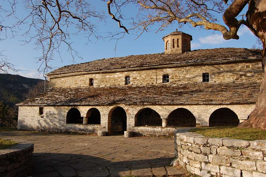
To designate a place means to name it officially. The Deputy Minister for Macedonia and Thrace also has the power to declare such settlements. The list names Vogatsiko in the Kastoria regional unit. Regional units are the districts that form each Greek region. Diporo stands on the same list for the Grevena unit.
Among the villages in Greece listed for Thesprotia are Margariti, Paramythia, Plesio and Sagiada. The Drama unit adds Perithorio and Pagoneri. For the Thessaloniki unit, the list names Ano Poli and Sykies. In the Karditsa unit, Ellinopyrgos and Rentina appear on it. The Kavala list takes in Kipia, Podochori and Zygos.
In 2021 the villages in Greece sat within 332 municipalities, split into 1036 municipal units and 6136 communities. A municipality is the lowest level of government in the state. In 1831 Ioannis Kapodistrias, independent Greece’s first governor, split the Peloponnese into seven departments. Those departments were divided into provinces, and then into towns and villages.
- Councils: A community council holds 5 to 15 members and has a president at its head.
- Role: Community councils are elected by voters, but their role is only to give advice.
- Aegean: The Ministry for the Aegean can also declare a place a traditional settlement.
Local government for the villages in Greece changed again in 2010. Law 3852, named Kallikratis, merged 900 municipalities and 133 communities into 325 municipalities. To merge is to join smaller bodies into one bigger body. Each new municipality can divide its land into municipal or local communities.
Why does Syrrako stand out among the villages in Greece?
The villages in Greece of North Tzoumerka, a municipality in Epirus, include Syrrako, 52 km south-east of Ioannina. The village stands at 1200 m on Mount Peristeri. It is built on a steep slope and keeps its traditional buildings.
A deep ravine of the Chroussias river splits Syrrako from Kalarrytes, its twin village. A ravine is a narrow, steep-sided valley. By local tradition, Chroussios, a son of Neoptolemos, drowned in this river and gave it his name. Syrrako is one of the villages in Greece where people speak Aromanian, the language of the Vlachs.
Aromanians, a people also known as Vlachs, had settled here before the 15th century. The age of the square’s plane trees supports this early date. After 1480 Syrrako was the capital of the Malakasioi, a self-governed union of 42 villages. The union belonged to the Valide sultan, the sultan’s mother, so these villages in Greece enjoyed privileged treatment.
Demand for capes made in Syrrako was high. Napoleon’s army is said to have been supplied with them. The travellers Leake and Pouqueville wrote in 1815 and 1818 that its trade matched the best European cities. They also noted important libraries and European newspapers there. In 1821 the village was burnt, and its people left to save their lives.
- Church: The church of the Panagia, the Virgin Mary, was among only five buildings left untouched.
- Poet: Kostas Krystallis (1868–1894), an author and poet, came from Syrrako.
- Statesman: Ioannis Kolettis, a Prime Minister of Greece, called Syrrako his hometown.
Its people came back in 1825 and built the whole village again. Between 1860 and 1870 it grew as grand as before. On 23 November 1912 Syrrako became one of the villages in Greece, after the First Balkan War.
Which business made Ampelakia famous in the villages in Greece of Thessaly?
The villages in Greece of the Tempi municipality include Ampelakia, nicknamed the jewel of Thessaly. Since 2011 the village has served as a municipal unit of Tempi. The village is also regarded as the historical seat of that municipality.
A municipal unit means an old municipality inside a larger one. Ampelakia’s unit holds two communities, Ampelakia and Tempi, across 54.447 km2. Ampelakia is one of the villages in Greece with no clear record of who founded it, or when. Church inscriptions and notes in church service books are the surest records of its start.
In 1580 Nikos Gameos bought a ritual book and gave it to the old church of Saint Paraskevi. A ritual book holds the words of church services. One old idea read the name as a village between two streams. Four streams cross it, so the idea fails. An 1899 register listed 700 vineyard owners on 1,100 acres.
Ampelakia counts among the villages in Greece where men, women and children all held shares in one cooperative. In a cooperative, the members own the business. Landowners took part with their fields and fund holders with their money. Craftsmen and workers took part with their labour. The cooperative ran 24 workshops, among them laundries and dyers’ shops.
- Board: Every third year the general meeting chose a board of five directors.
- Languages: People of Ampelakia spoke German, French, English and Italian with ease.
- School: From 1749, famous Greek scholars taught at the Ellinomousion, a college-type school.
In 1804 the people promised money to Anthimos Gazis to print a dictionary of the Greek language. A dictionary sets out words with their meanings. About 360 editions cover Ampelakia, one of the villages in Greece with a cooperative past.
How do the villages in Greece of Grevena show stone craft at Kalloni?
The villages in Greece of the Grevena municipality include Kalloni, 29 km north-west of Grevena town. It sits at about 980 m in the eastern foothills of the northern Pindus. Its stone houses date from the late 19th and the early 20th century.
Kalloni belongs to the Mastorohoria, a network of stone masons’ villages. A stone mason is a builder who shapes and lays stone. These villages in Greece cross the line between the Grevena and Voion municipalities. Only Kalloni, Pentalofos and Siatista are listed there under a 1978 decree that protects traditional settlements. A decree is a formal state order.
Kalloni is one of the villages in Greece with about 70 buildings set into a steep hillside. Dense oak forests surround it, broken by sandstone rocks. In sandstone, tiny grains of sand have hardened into stone. The community covers 9.447 km2. The settlement began in 1690, and the Monastery of Zavorda listed it in its archives in 1797.
Its old name was Lountsi, and it became Kalloni in 1927. Greek forces took the Grevena area during the First Balkan War, in early October 1912. In 1964 Grevena became a prefecture of its own, split from Kozani. Prefectures were the old regional districts. Kalloni stayed inside the new Grevena prefecture.
- Emigration: From 1945 to the early 1970s, heavy emigration drew people to cities and abroad.
- Residents: The 2021 census recorded just 13 permanent residents in Kalloni.
- Seasons: Families descended from the pre-war people return for holidays and retirement.
In 1915 Kalloni and other villages in Greece of the Sisani-Siatista diocese went to the Grevena subprefecture. Each diocese falls under one bishop’s care. A subprefecture was a smaller district inside a prefecture. That went against the village’s ties with Voion.
Where does Vitsa fit in the villages in Greece of Zagori?
The villages in Greece of central Zagori include Vitsa, one of the largest there. It stands at 955 m on a mountain slope close to the Vikos gorge, in north-west Greece. A gorge is a deep cut through rock with steep sides.
Vitsa is one of the villages in Greece with a famous old bridge, the bridge of Missios. It has two arches and dates from 1748. The village rests on a hill and spreads across both banks of two streams. A chasm, or deep crack, splits it into Ano Vitsa and Kato Vitsa, upper and lower.
Digs at Genitsari, near Vitsa, uncovered a settlement dated between the 9th and the 4th century BC. It possibly belonged to the Tymphaeans or the Molossians, two ancient peoples. A graveyard there held at least 140 graves. They contained coins, pottery and weapons. A document of 1361 names the village Vezitsa.
The name comes from a Slavic word for flight, from a root meaning run, flee or flow. Vitsa later became a cultural centre among the villages in Greece of Zagori. The Sarros family came from here, among them engineers on the Suez Canal works in the 19th century. Matthaios Paranikas, a scholar, writer and teacher, also came from Vitsa.
- Churches: Agios Nikolaos dates from 1612 and keeps well-preserved frescoes, or wall paintings.
- Older church: The church of Agios Georgios, also called the Taxiarches or archangels, dates from 1607.
- Feast: On 15 August Vitsa celebrates the Dormition, the feast of the Virgin Mary’s passing.
Between the 17th century and World War II, Vitsa emigrants went to Egypt, Asia Minor and the USA. Inside Greece they went mainly to Macedonia. Remittances, money sent home by emigrants, were the main income, as in other villages in Greece of Zagori.
How did Milies begin, as one of the villages in Greece on Mount Pelion?
The villages in Greece of South Pelion include Milies, a village and former municipality in Magnesia, Thessaly. Its municipal unit covers 63.754 km2. The village keeps traditional stone houses and cobbled roads, which are roads paved with rounded stones.
People fleeing pirate attacks on Milies, a place on the island of Euboea, founded the village. Pirates are robbers who attack from the sea. Milies is one of the villages in Greece built inland, away from the coast. From Milies the sea is in sight, yet the village cannot be seen from the sea.
No other Pelion community saw the War of Independence before Milies, in 1821. The War of Independence was the Greek revolt against Ottoman rule. Magnesia lost that fight and stayed outside the Greek Kingdom until 1881. In that year Milies became part of Greece, and the Ottomans left the area.
The Pelion Railway was built between 1895 and 1903. It proved a considerable economic advantage for the region. Mount Pelion’s streams and springs benefit Milies, one of the villages in Greece on its slopes. They bring rich plant life and cool, forested mountain slopes. Farmland beside the village yields fruit, olives and vegetables.
- Communities: The Milies unit also holds Kala Nera, Pinakates, Vyzitsa and Agios Georgios Nileias.
- Notable person: Daniel Philippidis, who lived from about 1750 to 1832, is a notable person of Milies.
- Fighter: Konstantinos Garefis (1874-1906) was a chieftain, or band leader, of the Macedonian Struggle.
Milies was among the villages in Greece burnt during the German occupation of World War II. On 4 October 1943 troops set fire to almost every house in the village. The municipal report says 25 men were executed. Three more residents died in their houses in the flames.
What history does Ouranoupoli add to the villages in Greece of Chalkidiki?
The villages in Greece of the Aristotelis municipality include Ouranoupoli, on the Athos peninsula coast in Chalkidiki. The modern village took its name from Uranopolis, an ancient city close by. An earthquake destroyed that city at a later date.
Ouranoupoli is one of the villages in Greece settled by refugees from Asia Minor in the 1920s. Asia Minor is the land that is now Turkey. The newcomers set up rug making there. In 1922 the Greek government took the area from Vatopedi Monastery to house Greek refugees from Turkey.
In 1926 the monks of Vatopedi leased the old Tower of Prosforion to Sydney and Joice Loch. To lease is to rent out property for a set time. Emperor Andronikos II had placed the tower under Vatopedi Monastery in the 13th century. The couple stayed there until their deaths, in 1955 and 1982.
In Ouranoupoli, one of the villages in Greece of Chalkidiki, the Lochs also owned a carpet-weaving business. It gave work to local people. Today the old tower houses the Christian Chalkidiki Exhibition. In 1956 the village gained a road, laid along the old pilgrim route. A pilgrim journeys for faith to a sacred site.
- Zygou Monastery: Abandoned in 1198, this monastery passed to Crusaders, Western soldiers of the holy wars, soon after.
- Castle of the Franks: Because of its Crusader past, the site is also known as Frangokastro.
- Agios Nikolaos: Ruins of this Byzantine church show it was in use between the 11th and 14th centuries.
For decades the Loch couple stayed on in Ouranoupoli, among the villages in Greece of Athos. In 1928 Sydney Loch and his wife Joice NanKivell Loch made the tower their home. It became a meeting place for monks and visitors passing to and from Mount Athos.
Which school nearly made Skamneli a university town among villages in Greece?
The villages in Greece of Zagori include Skamneli, 54 km north of Ioannina. It lies on the edge of Mount Tymfi at a height of 1160 m. Its name comes from the family name Skamnelis, given a feminine form to match the word for village.
Small nearby villages in Greece, such as Gardiki, Trepesi and Nouka, merged with Skamneli in the 17th century. Nouka was a small Aromanian, or Vlach, settlement at Gyftokampos. Old walls nearby are called Pelasgian, after an early people of Greece. Locals know them as the Palaiokastro, the old castle. Professor Daskaris dated them to the 8th century BC.
Remains of a round tower, dated to the 4th–3rd century BC, stand near the village entrance. A gate and two smaller doorways survive with it. Graves from Hellenistic times came to light in 2017. Hellenistic names the age of Greek kingdoms after Alexander the Great. In the 18th century the Saitzios School taught Classical Greek to boys and girls.
In 1820 the Saitzios School was proposed as the base of the first university of modern Greece. Backers later moved the plan to the monastery of St John of Rogov. It stands outside Tsepelovo, another of the villages in Greece of Zagori. Athens won the university after independence in 1829.
- Looms: Women of Skamneli worked looms, making garments, blankets and woollen cloth.
- Manors: Masons from Konitsa laid the foundations of the old manors, the large family houses.
- Church: The church of the Apostles rose next to the village square in 1793.
Skamneli is one of the villages in Greece that hold a festival for Agia Paraskevi, on 26 July. Nearby Gyftokampos hosts a yearly meeting of the Sarakatsani on the first weekend of August. The Sarakatsani are shepherds who speak Greek.
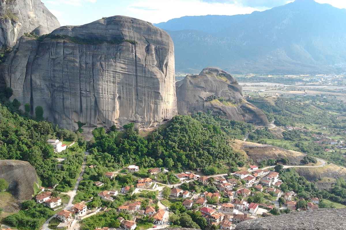
Which Meteora rocks surround Kastraki, among the villages in Greece?
The villages in Greece of the Kalabaka municipal unit include Kastraki, in Trikala, Thessaly. It fills a small valley that opens into the south-west side of the Meteora massif. A massif is one large, compact body of rock or peaks.
Cliffs ring Kastraki, one of the villages in Greece of Meteora, on all sides but the west. Two rock columns, Agion Pneuma, meaning Holy Spirit, and Surloti, stand on either side of the valley entrance. A tall, thin rock called Spindle Rock rises at the head of the valley. Beyond it, the rock mass leaves no room for building.
The name Kastraki comes from kastro, the Greek word for a Byzantine castle. Andronikos Palaiologos built that castle, and it stood until 1362. Only ruins remain today. In the early 1700s four hamlets, Rouxiori, Agia Paraskevi, Rigilavo and Triskiano, joined to form the village. A hamlet is a very small settlement.
Migrants from northern Epirus founded those hamlets while fleeing from the Ottomans. Northern Epirus here means the south of modern Albania. At the heart of Kastraki, among the villages in Greece below Meteora, stand a central plaza and church. In 2021 the village had 1,023 residents. It lies 275 metres above sea level.
- Trails: A wide network of footpaths links Kastraki to the rocks and monasteries around it.
- Modi rock: This rock east of the village held the historic Monastery of St Modestus.
- Pyxari rock: To the south, Pyxari held the Hermitage of Saint Gregory the Theologian, a hermit’s home.
The village area covers 47.9 km2. In 2016 Kastraki hosted the first Meteora mountain bike race. A mountain bike is a sturdy bicycle built for rough ground. Kastraki is one of the villages in Greece surrounded by the rocks of the Meteora complex.
What draws visitors to Agios Germanos in the villages in Greece near Prespa?
The villages in Greece of the Prespes municipality include Agios Germanos, in Western Macedonia. It lies in a valley below the Varnous Mountains, close to the border with North Macedonia. Stone houses, Byzantine churches and forests define its traditional look.
Among the villages in Greece, Agios Germanos sits close to both Prespa lakes, 7 km away. It stands at about 1,050 m. Kastoria lies 54 km away and Florina 45 km. Until 1926 the village went by the name German. Both names come from the old village church of Saint Germanus. Agios means saint in Greek.
The Stara river, also called the Agios Germanos river, runs through the village. It is one of four main streams that feed Lake Prespa. The endangered Prespa trout lives in its water. An endangered species faces a real risk of vanishing. Until the 1960s, 9 water mills worked along the river, and one was a sawmill.
The Byzantine church of Agios Germanos dates from the 11th century and holds important frescoes. Fresco painters work their colours into plaster while it is still damp. Near the village, a Byzantine Interpretative Centre sits in an Ottoman-era building. Agios Germanos is one of the villages in Greece visited for bird watching, above all the Dalmatian pelican.
- Old mills: A number of the old mills were restored in the early 21st century for heritage.
- Nature group: The SPP, or Society for the Protection of Prespa, was founded in Agios Germanos in 1990.
- Treaty: In 2000 Albania, North Macedonia and Greece signed a Lake Prespa treaty here.
Livestock, timber work and tourism carry the economy of Agios Germanos, one of the villages in Greece. Beans are its main crop. Each August, people with roots in the village return from Australia, Canada, the Czech Republic and Hungary.
Which feasts fill Vrysochori, high among the villages in Greece?
The villages in Greece of northern Zagori include Vrysochori, in the Tymfi municipal unit. It lies about 75 km from Ioannina, at 1157 m above sea level. Conifer forests and rivers surround it at the foothills of Gamila. Conifers are trees that carry cones.
Before 1927 the village was called Lesinitsa, and its Aromanian name is Leshnitsa. The scholar Ioannis Lambridis read the old name as hazel bush, a shrub that bears hazelnuts. Vrysochori ranks as the third largest of the villages in Greece of Zagori by land size. It lies just 5 km from the Aoos River.
Snowbanks stand there through every season of the year. A snowbank is a heap of packed snow. The village forest is the second biggest in Zagori, after the forest of Laista. Wild pigs and bears live in the area. The village also has its own water source, now shared with central Zagori.
Vrysochori was founded in 1295. The church of St Charalambos dates back to 1814. In 1943 German troops burnt much of the village. The village is Aromanian-speaking, with a dialect shared by Laista and Iliochori, two other villages in Greece. Each dialect carries its own local sounds and words.
- July feast: A three-day feast fills the village each year from 26 to 28 July.
- Hospitality: Villagers visit each other’s homes for tsipouro, a strong drink, and loukoumia, small sweets.
- Pie feast: On the first Saturday after 15 August, village women share homemade pies in the square.
Among the villages in Greece of Zagori, only Vrysochori holds a pie feast, begun in the early 1990s. Euterpe Bouki-Dukakis, mother of the American politician Michael Dukakis, came from Vrysochori. A local club issues a newspaper four times a year for its people worldwide.
Who settled Vlasti, one of the Aromanian villages in Greece?
The villages in Greece of the Eordaia municipality include Vlasti, at the heart of western Macedonia. Vlasti counts as both a village and a community, first settled in the 15th century. Before 1927 it was called Vlatsi, and in Aromanian it is Blatsa.
Vlach refugees from Grammos and Moschopoli reached Vlasti in the 18th century. A refugee is a person who flees home to find safety. Vlasti is one of the villages in Greece whose houses show its growth in the 19th century. In 1900 the writer Vasil Kanchov counted 1,300 Vlachs and 1,200 Greek Christians there.
The massifs of Mount Mouriki ring Vlasti, among the villages in Greece of western Macedonia. Here a massif means a solid mass of mountains. Mount Mouriki is home to the brown bear. It also shelters rare birds such as the short-toed eagle and the Egyptian vulture. The long-legged buzzard, a bird of prey, lives there too.
In summer Vlasti hosts the Earth Festival. It is a series of ecological and joyful events. Ecological means linked to nature and the environment. The festival aims to show why respect for the natural world matters. Visitors get to meet the locals and join them in the celebrations.
- Revolutionary: Ioannis Farmakis (1772 – 1821) was a leader of the 1821 revolt for Greek independence.
- Industrialist: Nikolaus Doumbas, an Austrian industrialist and liberal politician, had roots in Vlasti.
- Lawyer: Konstantinos Dosios, a lawyer and politician, is among the notable natives of Vlasti.
The 2021 census recorded 326 people living in Vlasti. Its community covers 72.089 km2 of land. Among the villages in Greece of Eordaia, Vlasti was an independent community before the 2011 reform. Vlasti has hotels, restaurants and bars for visitors.
Why is polyphonic song tied to Delvinaki among the villages in Greece?
The villages in Greece of the Pogoni municipality include Delvinaki, in Ioannina, a regional unit of Epirus. In 2021 the village had 538 residents, and its wider municipal unit had 1,609. Delvinaki belongs to the traditional area of Pogoni.
Delvinaki is one of the villages in Greece known as a home of polyphonic singing. Polyphonic singing joins a number of voices, each carrying its own line. With Parakalamos, it forms one of the two main centres of folk music in Pogoni. Every August the village holds a yearly festival of polyphonic singing.
Delvinaki’s church of the Dormition of the Theotokos dates from 1619. The Greek word Theotokos means God-bearer and refers to the Virgin Mary. In the late 17th century, Evliya Celebi described a wealthy town of 400 houses and 6000 vineyards. Evliya Celebi was a traveller from the Ottoman Empire.
Under Ottoman rule the town was a revenue estate of an Ottoman admiral. Its privileges freed it from taxes and imperial interference. After the Balkan Wars of 1913, Delvinaki became one of the villages in Greece. Once the Albanian border closed, Delvinaki took over from Pogoniani as the regional trade and government centre.
- Herds: Aromanian shepherds used Delvinaki as a summer stopover for grazing their herds.
- Settlers: After the years between the world wars, Aromanians settled here and now form the majority.
- Musicians: Long-settled Romani families live in Delvinaki, and a number of them are noted musicians.
Among the villages in Greece of Pogoni, Delvinaki counts the musician Petroloukas Chalkias among its notable people. Hatzimichalis Dalianis, a revolutionary leader when Greece fought for independence, is another. In the early 19th century, Henry Holland wrote that the town had 3000 inhabitants.
Why does Koroni stand out among the villages in Greece on the Messenian coast?
Villages in Greece include Koroni, a small town of Messenia at the southwest tip of the Peloponnese. Its shore runs along the Gulf of Messinia, a wide bay. In 2021, the census found 1,193 residents in the town of Koroni.
Pausanias was a geographer of the 2nd century who described the towns and villages in Greece. He placed the first Koroni at modern Petalidi, a town a short distance to the north. His account says the old town held temples to Greek gods and a copper-cast statue of Zeus.
Among the villages in Greece, Koroni later shifted to its present spot. That ground was once held by Asini, an ancient town. Across the 6th and 7th centuries AD, the Byzantines raised a fortress at the new site. The Byzantines were the Greek-speaking Romans of the eastern empire, who ruled from Constantinople.
Koroni first appears as a bishopric in a church list of Emperor Leo VI the Wise. A bishopric is a district led by a bishop, a senior priest of the church. In 1582 the fortress held 300 Christian and 10 Jewish households. A household is one family that lives under one roof.
- Trade: In the 18th century Koroni declined, yet it went on sending silk and olive oil abroad.
- Merchants: Four French merchant houses traded in the town until the 1770s.
- Island: The municipal unit of Koroni also takes in Venétiko, an island where nobody lives.
During the Morean War, a Venetian push to win the Peloponnese struck Koroni first. Venetian troops took Koroni, now one of the villages in Greece, in 1685 after a siege. Earlier, in the mid-14th century, the Black Death, a deadly plague, hit the Venetian colony hard.
What history does Desfina bring to the villages in Greece near Delphi?
Villages in Greece reach 680 metres at Desfina, which sits on a plateau in southern Phocis. Plateau here means raised, level ground. The town lies 5 km from the Corinthian Gulf. Since 2011 it has sat within the municipality of Delphi.
Among the villages in Greece close to Delphi, Desfina lies 7 km to its southeast. Itea lies 9 km to the west. Close to the town, scholars have matched old ruins with two ancient towns, Echedameia and Medeon. Here, ruins are the fallen walls and stones left by those towns.
King Philip II of Macedon destroyed both towns around 355-346 BC, in the Third Sacred War. Neither town was ever built again. Kastrouli, a set of late Mycenaean ruins, lies 4 km to the east. The Mycenaean age was the late Bronze Age in mainland Greece. Experts link Kastrouli with Anemoreia, a place named by Homer.
Bishop Isaias of Salona was a leading rebel of the Greek revolution. In 1821 he fought to free Desfina. Isaias gave the signal that began the revolution of Central Greece, at a place called Prophet Daniel. His house in Desfina, one of the villages in Greece tied to 1821, now serves as a museum.
- Church: The Temple of the Brigadiers, near the church of Saint Haralampos, dates from the 12th century.
- Produce: Local products include baked goods, olives and oil, grapes and wine, cheese and honey.
- Feast: The chief event, on 15 August, honours the Virgin Mary’s Dormition, or falling asleep.
Each summer the choir holds a traditional concert for the clarino, the Greek folk clarinet. Among the villages in Greece, Desfina still keeps its customs, traditions and feasts to a large degree. The central square of Desfina dates back to the 19th century.
Which crafts once fed Kastanitsa, one of the villages in Greece of Arcadia?
Villages in Greece with a Tsakonian past take in Kastanitsa, an Arcadian village counted as a traditional settlement. A majority of its people once spoke Tsakonian, an old form of Greek. In that tongue the village is called Gastenitsa.
A Byzantine fort called Koutoupou once stood on Pyrgos, a hill close to the village. Byzantine refers to the medieval Greek empire centred on Constantinople. In 1808 an Englishman, Martin Leek, wrote that the place had once been a city of great note. Today the village keeps around two hundred and fifty houses fit to live in.
The majority of houses are built of local stone. The Greek state lists the village as a heritage site and controls changes to outside walls. Among the villages in Greece, Kastanitsa once harvested as much as four hundred tonnes of chestnuts a year. Chestnuts also gave a dye used on leather and other goods.
The village has thirty lime kilns, ovens that burn limestone to make plaster. Men from Tsakonian villages in Greece spent the winter as travelling plasterers, as far north as Attica. A plasterer is a builder who coats walls with a smooth layer. They set out on Saint Demetrius’s feast day and came back for Holy Week, before Easter.
- Residents: Only around fifty people now live in Kastanitsa all year round.
- Chapels: Fifteen country chapels stand in the open countryside beyond the village houses.
- Monastery ruins: A church of Saint Pantaleon rises on the ruins of a Saint Nicholas monastery founded in 1628.
Kastanitsa ranks among the villages in Greece where cars are not driven, apart from a handful of cases. Since cars came, winter population loss has grown faster. The old Saint Nicholas monastery was destroyed in 1826 by the troops of Ibrahim Pasha.
How does an ancient cure link Antikyra with the villages in Greece by the Corinthian Gulf?
The villages in Greece along the Gulf of Corinth also cover Antikyra, a port. It lies on the west shore of the Gulf of Antikyra, which carries its name. That gulf is a bay on the north coast of the larger Gulf of Corinth.
Inscriptions show that Antikyra, one of the villages in Greece, has kept the same name since classical times. Such inscriptions are lettering chiselled into stone or metal. Legend ties the name to Antikyreos, who healed the madness of Hercules with local hellebore. Hellebore is a poisonous plant used in ancient medicine.
According to Pausanias, black hellebore worked as a laxative and white hellebore as an emetic. A laxative clears the bowels, while an emetic makes a person vomit. Among the villages in Greece, Antikyra had started a temple to Artemis by 330 BC. Its statue was ordered from the sculptor Praxiteles.
During the 2nd century BC, Antikyra minted its own bronze coins bearing the head of Poseidon. Greek legend made Poseidon master of the sea. Pausanias saw a bronze figure of the god with a foot set on a dolphin. Around AD 620, a large earthquake wrecked the greater part of the city.
- Basilica: A large church with five naves and a mosaic floor came to light in the 1980s.
- Catalan name: During Catalan rule in the Middle Ages, the town went by the name Port de Arago.
- White houses: Under Ottoman rule its name became Aspra Spitia, after its white houses.
In 1806 William Martin Leake found an inscription with the old name, linking the site to ancient Antikyra. Before about 1810, fewer than 200 people lived in the village. In 2015 Antikyra, one of the villages in Greece by this gulf, had 699 residents.
What did a medieval barony give Karytaina among the villages in Greece?
Villages in Greece of Arcadia number Karytaina among them. Its houses climb the flanks of Achreiovouni hill, around 550 metres above sea level. Since a 2011 reform, Karytaina has sat inside the municipality of Megalopoli, a local council area.
Among the villages in Greece, Karytaina has a site that scholars commonly match with Brenthe, an ancient city. The Greek archaeologist N.K. Moutsopoulos has proposed that a 12th-century church once stood inside the castle. A settlement certainly stood there before the Franks, crusader knights from the West, conquered it around 1205. Archaeologists study old remains.
Under the Crusaders, Karytaina ranked among the largest baronies of the Peloponnese. A barony was land held by a noble called a baron. Its position gave it control of southern Skorta, a mountain area, and of the main road to Elis. Baron Geoffrey of Briel defied even Prince William II of Villehardouin, more than once.
Under Ottoman rule, the town grew as a district centre and a market, above all for wheat. As the 18th century turned, François Pouqueville listed 130 villages in Greece’s Karytaina district. The castle has a triangular outer wall. Its long sides run over 110 m, and its base around 40 m.
- Barons’ home: A central building inside the castle, home of the barons, sat above its water cistern.
- Castle church: Theodoros Kolokotronis repaired the castle and raised a small church there to the Virgin Mary.
- Summer events: In August, Karytaina hosts a series of events, led by the yearly Women’s Bazaar.
Among the villages in Greece, Karytaina also keeps a cathedral of the Annunciation, built in 1878. The Annunciation marks the angel Gabriel’s message to Mary. The Church of the Life-giving Spring, from the 15th century, stands out for its tall bell tower.
Which ancient town lies beneath Agia Efthymia, one of the villages in Greece?
Villages in Greece of Phocis count Agia Efthymia among them. It belongs to the municipality of Delphi, below the slopes of Mount Giona. Giona is the highest mountain of Central Greece. The village is part of the district of Parnassida.
Agia Efthymia is one of the villages in Greece that occupy the ground of an ancient town. In ancient times that town was called Myonia. Classical writers call it a polis, or city-state, of the Ozolian Locrians. Parts of its defence walls survive in and around the village, beside traces of an old cemetery.
Pausanias wrote of a grove and an altar there for gods called the Meilichioi, honoured at night. By custom, worshippers had to finish the meat where they stood, before the sun rose. At Olympia, a bronze-plated shield in the Temple of Zeus carried a dedication from the Myanians. Pausanias took them to be the people of Myonia.
The ancient name lasted until 1580, in the slightly changed form Mynia. That year a huge earthquake in Phocis destroyed Mynia, among other towns and villages in Greece. Residents believed that an old, long-bearded man who appeared to them was Saint Euthymius. They rebuilt their homes and gave the village his name, Agia Efthymia.
- Local name: Residents call the village Aithymnia, a name near in sound to ancient Mynia.
- Work: Locals farm olives and keep herds, and a good number mine bauxite, the ore of aluminium.
- Finds: In 1928, graves at Kazas yielded iron swords and a bronze helmet from the 6th century BC.
Nikodimos Kavassilas, a teacher and monk born here in 1595, founded one of only three schools in Phocis. The 2021 census counted 374 residents in Agia Efthymia, among the villages in Greece of Phocis. The writer Giannis Skarimpas was born and raised in the village.
How did Dimitsana train church leaders among the villages in Greece?
Villages in Greece on the register of traditional settlements feature Dimitsana, in the hills of Arcadia. Its old buildings form a typical sample of the architecture of Gortynia, the local district. The village lies 23 km northwest of Megalopoli and 17 km northeast of Andritsaina.
Among the villages in Greece, Dimitsana keeps a historical library, a school and an open amphitheatre. Until 1821 the library kept growing, as the Patriarchate sent new books. The Patriarchate here means the church leadership based in Constantinople. A seminary, a school for priests, also worked there. Its name was the Tuition Centre of Greek Literature.
Germanos III of Old Patras was among the bishops and scholars who studied at the seminary. His house still stands in Dimitsana, one of the villages in Greece. The house of Patriarch Gregory V has also survived there. Gregory V served as Ecumenical Patriarch, the senior Orthodox bishop. A statue of him rises over the central square.
After the Orlov events, families named Tasoulis left Dimitsana for Asia Minor. The Orlov events were a Greek uprising backed by Russia. In 1777 they reached Koldere, near Magnesia, and changed their name to Tasopoulos. In 1960 Dimitsana had about 2,000 people. Since then, a large share have left to settle in Australia, America and other countries.
- Library museum: The museum inside the library also keeps an archaeological collection of finds.
- Mills: Dating from 1997, an open-air museum of water power fills restored, abandoned pre-industrial workshops.
- Old school: The elementary school served as a girls’ school until 1930, and later as a county court.
Theophanes III, a Greek Orthodox Patriarch of Jerusalem, came from Dimitsana. In the municipal unit, Zatouna forms a community with Vlongos and Markos, two other villages in Greece. A community here is the smallest unit of local rule.
Where did ancient Palairos stand, among the villages in Greece by the Ionian Sea?
Villages in Greece sometimes carry two names, and Palairos in Aetolia-Acarnania is also known locally as Zaverda. Zaverda served as its official name until 1928. The 2011 reform placed it, as a municipal unit, in the municipality of Aktio-Vonitsa.
Palairos is among the villages in Greece that stand beside the ruins of an ancient city. That city lay in southern Epirus. Sections of its walls seem to go back to 2000 BC, in Mycenaean times. The walls mix square-cut blocks with polygonal stones, which have irregular edges.
The ruins lie high in the mountains above the Ionian Sea and Lake Vourkaria. Experts think the city once held over 10,000 people. The geographer Strabo placed Palairos on the west coast, between Leucas and Alyzia. In antiquity the city belonged to Acarnania. The citadel, or inner fort, on the eastern side counts as the oldest part.
In 431 BCE, the first year of the Peloponnesian War, Palairos was an ally of Athens. Its two sides were led by Athens and by Sparta. When the Athenians took Sollium, a Corinthian colony, they gave the town and its land to Palairos. Colony here means a town settled by Corinthians.
- Actium: At Actium, close to Palairos, Octavius defeated the forces of Mark Antony and Cleopatra.
- Salt lake: Local tradition says the salt lake saved Cleopatra, who hid her ships in its waters.
- Names: The municipal unit began in 1994 as the municipality of Kekropia and became Palairos in 2004.
In 1997 a reform added the former communities of Vatos, Plagia and Peratia to the unit. The Kapodistrias reform joined small communities of villages in Greece into larger municipalities. Palairos and these settlements now stand among the villages in Greece of Aktio-Vonitsa.
What medieval story does Chalandritsa add to the villages in Greece?
Villages in Greece close to Patras hold Chalandritsa, a hill town 17 km south of the city. Its hills lie to the north of the river Peiros. Since 2011 the town has been the administrative centre of Erymanthos municipality.
Pouqueville traced the name to Chalasmeni Tritaia, or broken Tritaia, a hint at bad climate. The historian Stefanos Thomopoulos told another story: a feared bandit named Andritsos was slain here in Byzantine times. People have lived at Chalandritsa, one of the villages in Greece of Achaea, since the Paleolithic era. The Paleolithic era is the Old Stone Age.
Work on a new health centre near the locality of Stavros uncovered remains of a prehistoric settlement. The houses of this early village ringed the edge of the hill. Experts assume a public building or a temple stood at the centre. A Mycenaean cemetery has also come to light nearby.
Under Frankish rule in the 13th and 14th centuries, Chalandritsa broke away from the Barony of Patras. The French Dramelay family ruled it first, and the Genoese Zaccaria family later. The Chronicle of the Morea gives its French name as Calandrice. Chalandritsa, today among the villages in Greece, was the last barony left in Frankish hands.
- Fall: In 1429 the barony fell to the Despotate of the Morea, ending the Principality of Achaea.
- Churches: The Byzantine churches of St Athanasius and the Dormition stand among the village sights, beside a Frankish tower.
- Old finds: Pottery and stone tools from the 11th century BC have turned up at the site.
The community of Chalandritsa groups three settlements: Chalandritsa itself, Mastoraiika-Stamaiika and Kydonies. Watermills and springs also rank among its sights, a watermill being a mill turned by flowing water. Among the villages in Greece near Patras, Chalandritsa also keeps a traditional centre.
How has Galaxidi rebuilt itself through the ages among the villages in Greece?
Villages in Greece of southern Phocis extend to Galaxidi, a town by the sea. It lies 7 km southwest of Itea and 15 km southwest of Delphi. Delphi municipality has counted it as one of its units since 2011.
Galaxidi is among the villages in Greece with Mycenaean remains, found at a spot called Villa. On the hill of St. Athanasios, digs revealed a walled Geometric settlement of around 700 BC. Geometric refers to the line patterns painted on pottery of that age. Around 300 BC, people settled the present site and ringed it with a wall.
The ancient town of Haleion thrived through Hellenistic and Roman times until the 2nd century AD. Galaxidi, now one of the villages in Greece, first appears in records in the late 10th century. In that period, a Bulgarian raid under Tsar Samuel destroyed it. Its people fled to offshore islands, and nobody resettled the town for 50 years.
Norman invasions in 1081 and 1147 laid the town waste once more. The Treaty of Küçük Kaynarca dates from 1774. From then on, Galaxidi shipowners in large numbers sailed under the Russian flag. A flag shows where a ship is registered. In the early 20th century, school children planted a pine forest beside the larger harbour.
- Old church: The Hospitallers, a crusader order of knights, built a Church of Saint John of Jerusalem here in 1404.
- Bronze abroad: Fifteen museums in Europe and America hold over 100 bronze vessels from Galaxidi.
- Museum house: Both museums fill a mansion from around 1870 that once held a girls’ school and town hall.
The smaller of its two harbours is called Chirolaka. The Archaeological Collection of Galaxidi opened in 1932 to hold finds donated by local people. Among the seaside villages in Greece, Galaxidi has seen commercial fish farming grow in recent years.
When did Stemnitsa serve as a seat of government among the villages in Greece?
Villages in Greece of Trikolonoi, in Arcadia, centre on Stemnitsa, once the seat of that former municipality. It rises above the river Lousios, on its left bank. Dimitsana is 6 km to its north-west, and Tripoli 26 km to its east.
Hypsous, the ancient city linked with Stemnitsa, traced its founding to one of Lycaon’s sons. In Greek myth, Lycaon was a king of Arcadia. Hypsous lay near Thyraion, known today as Pavlia. Under Ottoman rule, its remote spot made Stemnitsa a fairly safe haven among the villages in Greece. It grew into a hub of Greek culture and faith.
Ottoman tax records from 1512 to 1515 show about 120 families in the village. The two larger churches of Stemnitsa are Ai-Giorgis and Agia Paraskevi. Ai-Giorgis is the local name for Saint George. During the Greek War of Independence, Kolokotronis and his clan found shelter here with other fighters.
In 1821 Stemnitsa, among the villages in Greece of Arcadia, became the earliest base of the Peloponnesian Gerousia. This council of elders, or gerousia, ran the freed Peloponnese as a stopgap government. Its members gathered in the Zoodochos Pigi monastery, a name meaning Life-giving Spring. Gennaios Kolokotronis, later a Prime Minister of Greece, came from the village.
- Folk museum: The folklore museum also shows how shoes were mended and how copper ware was tinned.
- Monastery: Built around 1167, the St John the Baptist monastery clings to a rock face 7 km away.
- Ancient hospital: Excavations near the monastery reveal an ancient hospital honouring Asclepius, the Greek god of medicine.
The painter Georgios Roilos of Stemnitsa was among the first to bring impressionism into Greek painting. Impressionism paints light and fleeting moments. He also taught and mentored Giorgio de Chirico. Among the villages in Greece, Stemnitsa keeps its old library as a monument by the square.
How did Methoni serve pilgrims and traders among the villages in Greece?
Villages in Greece of Messenia lead south to Methoni, the southern end of Greek National Road 9. That road runs south from Patras through Kyparissia. In the reform of 2011, the village of Methoni joined the municipality of Pylos-Nestor.
Among the villages in Greece, Methoni held a key harbour in Byzantine times. During the Fourth Crusade, the knight Geoffrey of Villehardouin was shipwrecked near Methoni. He stayed there through the winter of 1204/5. In 1212 the Pope took the Latin Bishopric of Modon, as Venetians called Methoni, under his personal protection.
Under Venice, Methoni became a key stop on the sea road from Venice to the Holy Lands. Pilgrims, travellers on a journey of faith, left a good number of written accounts of the town. By the late 14th century, Greeks, Jews, Albanians and Latins, or western Catholics, lived there side by side.
In 1532 the Knights Hospitaller, a crusader order, briefly retook the fortress. The Venetians came back under Francesco Morosini in 1686. Soon after, a Venetian census found only 236 people living in Methoni. After 1725 the town once again became a centre of trade with the Ottoman lands of North Africa.
- Painting: One reading of Carpaccio’s Young Knight in a Landscape sees the knight as Marco Gabriel.
- Governor: Marco Gabriel, a Venetian noble, served as rector, or governor, of Methoni during an Ottoman siege.
- Nearby villages: The municipal unit also holds Foinikounta, Lachanada, Kamaria and Evangelismos, among other villages in Greece.
Methoni, one of the villages in Greece of Messenia, lies 11 km west of Foinikounta. In 1770, in the Orlov Revolt, Russian forces under Prince Dolgorukov besieged the castle at length. Unable to storm the walls, the attackers relied above all on cannon fire.
What surrounds Andritsaina, one of the villages in Greece in the hills of Elis?
Villages in Greece of the Elis hills cluster around Andritsaina, the main village of its local community. The 2011 reform made it part of Andritsaina-Krestena municipality. The village lies 22 km northwest of Megalopoli and 41 km west of Tripoli.
Early explorers Ludwig Ross and Ernst Curtius wrote of ruins to the north of the village. They wrongly tied those ruins to Theisoa, an ancient place name. Nobody has found or recorded the ruins since then. Andritsaina lay in ancient Arcadia, though it now ranks among the villages in Greece of Elis.
The village thrived while the Franks ruled, in the 13th and 14th centuries. A medieval account of the Frankish Peloponnese, the Chronicle of the Morea, mentions it. Andritsaina played a crucial part in two struggles: the Orlov Revolt and, later, the Greek War of Independence. Revolutionary leaders Panagiotis Anagnostopoulos and Anastasios Christopoulos both came from the village.
Old mansions and cobblestone streets still shape the village today. The village library keeps rare manuscripts from the 16th and 17th centuries, in Greek and other languages. A manuscript is any document copied out by hand. It also holds papers from the War of Independence and a rich store of folklore.
- Bassae: Bassae, with its Temple of Apollo Epicurius, lies 6 km south of the village, in Messenia.
- Mountain villages: The community also includes three small mountain villages in Greece: Karmio, Myloi and Sykies.
- Scholar: Konstantinos Nikolopoulos, a composer, archaeologist and philologist, or student of old texts, came from Andritsaina.
Among the villages in Greece of Elis, forestry and small-scale farming are the main land uses around Andritsaina. Greek National Road 76, linking Krestena, Karytaina and Megalopoli, runs through Andritsaina. Forestry is the care and use of woodland for timber.
Which Naxos story does Filoti add to the villages in Greece?
Villages in Greece on Naxos include Filoti, a semi-mountain village in the centre of the island. Semi-mountain means it stands on raised slopes, partway between the lowlands and the high peaks. The 2021 census counted 1,617 residents in Filoti.
Filoti is built across the slopes of two hills. The village is made up of three separate settlements. Among the villages in Greece on Naxos, Filoti has the municipal community with the largest acreage. Acreage means the size of an area of land. A municipal community is a unit of local rule that elects a council.
Finds from the nearby Cave of Zas show human presence in the later Neolithic period, 4300-3200 BC. Neolithic is the name for the New Stone Age. Much later, Marco I Sanudo divided Naxos into 56 fiefs. A fief was an estate held from a lord. One fief in that list bore the name Filotis.
Filoti keeps the ancient custom of Chirosfagia on Tsiknopempti, together with carnival events. Chirosfagia is the Greek word for the slaughter of pigs. Tsiknopempti is the Thursday of carnival when Greek families grill meat. Carnival is the feast season before the fast of Lent. Filoti is one of the villages in Greece where this custom still takes place.
- Aria: Around 1344 pirates destroyed nearby Aria, and its survivors were moved to Filoti.
- Barozzi Tower: In 1620 a tower-like mansion at the heart of the village passed by sale to Zorzeto Barozzi.
- Refugees: Refugees from Crete found a home in Filoti in 1669, once the Ottomans had seized Crete.
Filoti holds more residents than any other village on the island of Naxos. Population means the count of people who make their homes in one place. Measured in that way, Filoti comes first among all the villages in Greece that stand on Naxos.
How did Apeiranthos earn its place among the villages in Greece?
Villages in Greece on the island of Naxos include Apeiranthos, a mountain village also known as Aperathos. In the local dialect, people call it Aperathou. Dialect means the speech of one area, set apart by its own words and sounds.
Its site lies 28 km from the Naxos capital, to the north-east. It rises on the foothill of Mount Fanari, between 650 and 700 m up. Foothills are the lower rises below a mountain. Its dialect and traditions resemble those of mountain villages on Crete. One group of historians concludes that Cretans built it in the 10th century.
Apeiranthos is one of the villages in Greece with four museums of its own. One is an archaeological museum, which keeps objects from the ancient past. Another shows folk art, meaning the crafts of ordinary country people. A geological museum covers rocks and minerals. A natural history museum covers plants and animals.
Manolis Glezos was born in Apeiranthos, one of the villages in Greece on Naxos. He moved to Athens with his family in 1935. In 1986 he was elected President of the Community Council of Aperathu. Aperathu is the local form of the village name. A community council is the elected body that runs a small local area.
- First record: The village first appears in 1420, in Cristoforo Buondelmonti’s Liber insularum archipelagi, a Latin book on the islands.
- Paris: Petros Protopapadakis, born in Apeiranthos, studied mathematics and engineering in Paris, the French capital.
- Main villages: Koronos, Glynado, Vivlos, Agios Arsenios, Filoti and Apiranthos rank as the main villages of Naxos.
With 722 residents in the 2011 census, Apeiranthos is the second largest village on Naxos. Only Filoti holds more people. That census was the national count of every resident in Greece. These two villages in Greece head the list of Naxos villages by size.
What past lies behind Oia, one of the villages in Greece on Santorini?
Villages in Greece on Santorini include Oia, a small village whose name is said as “ia”. Its district takes in all of Therasia plus the far north-western corner of Santorini. A district here means the area one local unit of government looks after.
Ancient Thera, the island’s old city, had two harbours, and one of them bore the name Oia. It lay in the south-east, where Kamari stands today. The modern village keeps a residential keep called Goulas. In a castle, the keep is the main tower that housed the lord. Goulas stands on the south-western edge, in the oldest quarter.
At the top of Oia stands a ruined castle. Under the Venetians, the Argyri family had its seat in this castle. The Venetians were rulers from the Italian city of Venice. A seat is a noble family’s main home. Oia is one of the villages in Greece where such a castle ruin crowns the summit.
Wine was made in quantity in the hinterland of Oia. Hinterland means the farmland behind a coast or a town. France was among its export markets. Among villages in Greece, Oia also had an old boatbuilding bay. The Bay of Armeni, to its south-west, was once an important centre of that craft.
- Self-rule: Oia ran as an independent community between 1840 and 1851, with its own local government.
- Prize: In 1986 the Sofia Biennale, a show held every two years, gave a prize for work in Oia.
- Geology: The Oia community works with geologists, scientists of rock, from Athens and Thessaloniki universities on ground stability.
Capers, fava beans, wine and honey are farm goods traded in Oia, one of the villages in Greece. Capers are unopened shrub buds kept in salt or vinegar. Fava is a Greek name for a yellow pulse, a dried seed crop.
Why do ancient laws link Ioulis to the villages in Greece?
Villages in Greece on Kea include Ioulis, also called Ioulida, the capital of the island. Islanders call it Chora, a word used for the chief town of a Greek island. Kea belongs to the Cyclades, one of the Greek island groups.
Ioulis is one of the villages in Greece where cars must be left at the entrance. Drivers leave their vehicles outside, and people enter the town on foot. The way the houses are built here differs from the typical Cycladic style. That common style means white, cube-shaped houses with flat roofs, seen across the Cyclades.
The ancient city, Iulis, was famed as the home town of Aristo, Erasistratus, Prodicus, Bacchylides and Simonides. A nineteenth-century account placed it on a hill about 25 stadia from the sea. A stadion, plural stadia, was a Greek length measure of the ancient world. Among villages in Greece, Ioulis stands on that same ancient site.
The laws of Iulis won wide praise in ancient times. As a result, the phrase “Cean Laws” became a proverb for any excellent institutions. Cean means of Kea, from the old island name Keos. A proverb is a well-known saying passed from person to person. Institutions here means the rules and customs that order public life.
- Morals: These laws dealt with the morals of the citizens and with their way of life.
- Merger: By the 2nd century BC, Ioulis and Karthaia had absorbed the cities of Koressos and Poieessa.
- Square: A square with the grand city hall forms the heart of the town.
The 2021 census counted 1,225 inhabitants in Ioulis. A census counts each resident of the nation, one district at a time. With that number, Ioulis counts among the villages in Greece that serve as the capitals of their islands.
Where does Kastro on Sifnos sit among the villages in Greece?
Villages in Greece on the Cycladic island of Sifnos include Kastro. The small settlement counted 124 inhabitants in the 2021 census. Cycladic means part of the Cyclades island group. Kastro is a Greek word that means castle, a fortified building.
Among villages in Greece, Kastro is built on top of a steep hill near the east coast. The houses stand at an altitude of 80 metres. Altitude means height measured from sea level. Below the hill lies a small bay. In earlier times that bay was the settlement’s port.
The best estimate places the founding of Kastro in the 14th century. Its builders were possibly the House of Coruña, a noble family. A noble family holds a title and land passed down through the generations. Early in the 17th century, Kastro was the main village of Sifnos. Its population then was estimated at 5000 residents.
Kastro is one of the villages in Greece built at a small scale. A typical building there covers around 30 square metres. It rises to one or two floors, the ground floor included. Square metres measure floor area, as metres measure length. The ground floor is the level that sits at street height.
- Museum: Kastro has hosted the Archaeological Museum of Sifnos since it opened in 1986.
- Collections: Its rooms hold sculptures, pottery and coins from Greek and Roman antiquity, meaning ancient times.
- Building: The building that houses the museum belongs to the medieval core of the settlement.
Three Roman sarcophagi still lie in the streets of Kastro, one of the villages in Greece on Sifnos. A sarcophagus is a carved stone coffin. The museum there keeps 80 Byzantine coins. Byzantine coins come from the empire that had its capital at Constantinople.
What makes Volax on Tinos stand out among villages in Greece?
Villages in Greece on Tinos include Volax, set on a small plateau at the heart of the island. Its average altitude is 284 m above sea level. A plateau is an area of fairly flat land set high above its surroundings.
Volax is a small village on the island of Tinos, with Volakas as its second name. Tinos belongs to the Cyclades, the island group named from the Greek word for circle. A good number of its houses stand above the rocks, close together. Their design keeps to old Cycladic building rules.
Volax is one of the villages in Greece dating from the 14th century or before. It ranks among the oldest villages of Tinos. Venetian state papers of 1618 recorded it under the name Volacus. At that time Venice, an Italian sea power, ran the island’s government. State documents are the official papers of a government.
Among villages in Greece, Volax draws athletes from all over the world at Easter. They gather to train on the rocks around the village. Their sport is bouldering. Bouldering means climbing large rocks close to the ground, without ropes. Easter is the Christian feast that marks the rising of Jesus from the dead.
- Craft: Volax has long been a home of basket weavers, people who make baskets by hand.
- Museum: Volax keeps a small folklore museum, a place for old local customs and crafts.
- Stage: A 380-seat amphitheatre, an open stage ringed by tiers of seats, hosts music and plays.
The 2011 census counted 51 residents in Volax. A resident is a person whose permanent home is in a place. With that figure, Volax counts as a hamlet among villages in Greece. A hamlet is a tiny village with only a handful of homes.
Which ancient ruler ties Lindos to the villages in Greece?
Villages in Greece on the island of Rhodes include Lindos. It lies about 40 km to the south of Rhodes city. Its fine beaches make it a popular place for holidays and tourism. The island and its main city share the same name.
According to myth, Dorians led by Tlepolemus, a king of Rhodes, founded Lindos. They arrived in about the 10th century BC. The Dorians were an ancient Greek people with their own dialect of Greek. A myth is a traditional story handed down from early times. Among villages in Greece, Lindos carries such a founding tale.
The massive temple of Athena Lindia towered over the acropolis of Lindos. It reached its final form around 300 BC. An acropolis is the upper, walled citadel of an ancient Greek city. The site also holds a stoa that was 87 metres long, with 42 columns. A stoa is a roofed walkway with columns.
Below the acropolis steps at Lindos, one of the villages in Greece, a relief is cut into rock. It shows a Rhodian trireme, a warship powered by three tiers of rowers. A relief is a carving that projects from a flat background. On the bow, or front, stood a statue of General Hagesander by Pythokritos.
- Area: The municipal unit of Lindos covers 178.9 square kilometres of the island of Rhodes.
- Colossus: Chares of Lindos, a sculptor from the village, built the Colossus of Rhodes, a giant ancient statue.
- Warmth: With an annual average of 22 °C, Lindos is the warmest area of Greece each year.
Cleobulus was the ruler of Lindos in the 6th century BC. He is listed with the Seven Sages of Greece. The Seven Sages were ancient Greek wise men known for short sayings. Lindos is one of the villages in Greece with a ruler from that group.
How did flowers give Paradeisi its name among the villages in Greece?
Villages in Greece on the north coast of Rhodes include Paradeisi. The name Paradeisi is simply a Greek form of the word paradise. Paradise means a garden of complete happiness, as told in old stories and in holy books.
Under the Knights of Saint John, the magister Villeneuve built a castle here. The castle was meant to guard north-east Rhodes from pirate raids. A magister was the leader of the order of knights. People then began to build homes around the castle. Paradeisi thus grew as one of the villages in Greece around a castle.
Later, Arab inhabitants planted exotic flowers along the mountain of the village. The slope came to look like paradise, and the village took its name from that. Exotic means brought from a far-off land. Under Italian rule the village was renamed Villanova, which means new village in Italian. It became Paradeisi again after Greece reclaimed it.
A strawberry festival takes place in Paradeisi every year, on the first Sunday of the fifth month. Local producers bring strawberry fruit and strawberry products. The festival also includes music and events. A festival is a yearly public celebration on a fixed date. Paradeisi is one of the villages in Greece with such a fruit festival.
- Airport: The main airport of the island of Rhodes is located at Paradeisi.
- Population: The 2021 census counted 2,623 inhabitants in Paradeisi, meaning people who live there.
- Saint Marina: The feast of Saint Marina is celebrated in the village on 17 July every year.
Paradeisi is the second-largest town in the municipal unit of Petaloudes, after Kremasti. A municipal unit is one district inside a larger municipality. Petaloudes means butterflies in Greek. Among the villages in Greece on Rhodes, Paradeisi ranks second in its district by size.
Why is Kritinia called New Crete among the villages in Greece?
Villages in Greece on Rhodes include Kritinia, a village that forms a community within the Attavyros municipal unit. Here, a community is the smallest area of local government. Rhodes is a Greek island, and Attavyros is one of its local districts.
Kritinia is one of the villages in Greece whose name means New Crete. Families who fled Crete in the era of Turkish rule founded it. In Greek, Crete is called Kriti, and the village name grows from that word. Turkish rule means the centuries when the Ottoman Empire governed the region.
At first the settlement stood by the coast, where Kameiros Skala lies today. After the Byzantine era it moved up into the hills, for safety from pirates. In 1472 Giorgio Orsini built the castle of Kastellos above the village. It was meant to shield villagers from attacks by Ottoman fleets. Fleets are whole groups of warships.
Until the Dodecanese became part of Greece, the village bore the name Kastelli. That name came from the Latin word Castellum, which means castle. Latin was the speech of Rome in ancient times. The Dodecanese are the island group that includes Rhodes. Among villages in Greece, Kritinia has carried two names.
- Setting: Kritinia sits on a hillside, with Mount Attavyros on one side and the west coast on the other.
- Kameiros Skala: Despite its name, Kameiros Skala lies about 14 km from ancient Kameiros.
- Morosini: In 1658 the Doge, or ruler, of Venice, Francesco Morosini, tried to take Rhodes but was repelled.
In 2021 the community of Kritinia had 388 people. That figure includes the coastal locality of Kameiros Skala. A locality is a named spot with its own homes. By that count, Kritinia is a small community among the villages in Greece on Rhodes.
What springs and crafts give Salakos a place among villages in Greece?
Villages in Greece on Rhodes include Salakos, where people work mainly in farming, livestock rearing and tourism. Livestock rearing means raising farm animals for meat, milk or wool. Tourism is the business of hosting visitors who travel for pleasure.
The hills around Salakos belong to Mount Prophitis Ilias. The mountain’s name means Prophet Elijah. Next to the village lies a natural spring called Nimfi. The spring takes its name from the Nymph, a spirit of myth who guarded springs and running water. Salakos is one of the villages in Greece with such a named spring.
In 1422 Antonio Cattaneo received the rural lands of Salakos as a fief. He came from a family of Genoa, a port city of north-west Italy. A fief was land held in return for loyal service. Much later, the Italians designed the new platea, a village square with trees and an ornate stone fountain.
Near the square lie walls of a minor fort built by the Knights of St John. These knights were a Christian order of soldier-monks of the Middle Ages. Under Ottoman rule, the fort’s stones built a small one-room mosque. Mosque is the name of a Muslim place of worship. It stayed in use until the 1950s.
- Chairs: A chair-making industry once flourished in Salakos, but it has now diminished.
- Mill: Among villages in Greece, Salakos keeps a ruined mill run by animal and water power.
- Press: Near the castle, the small oil and wine press of the village has recently been restored.
Salakos is home to 500 people and lies on the western side of Rhodes. Its Greek name is written Σάλακος. The Greek alphabet is the set of letters used to write Greek. Among the villages in Greece on Rhodes, Salakos belongs to the island’s west side.
Which old city lies behind Olympos among the villages in Greece?
Villages in Greece on Karpathos include Olympos, a village and former self-governing community in the north. Self-governing means it once ran its own local affairs. Karpathos is an island of the Dodecanese group. The Dodecanese are a chain of Greek islands.
The Doric city of Vrykous stood on this spot in antiquity. Doric refers to the Dorians, a people of ancient Greece. Karpathos had three ancient cities, and Vrykous was one of them. Antiquity is the ancient period, before the Middle Ages. Among villages in Greece, Olympos stands where a city once stood.
Today only a small part of the city survives, along with its walls. There are also graves and three old churches built for Christian worship. Greek grammar treats the village name as feminine and the mountain name as masculine. The village is I Olympos, and the mountain is O Olympos, using two forms of the word the.
Local villagers mainly use the name Elympos for their home. Elympos is a local form of Olympos, with an E in place of the O. A local form is a version of a name used in one place. In Greek letters it is written Έλυμπος. Among villages in Greece, Olympos thus keeps two names side by side.
- Municipal unit: Since the 2011 reform, Olympos has formed one unit within the Karpathos municipality.
- Land area: The community of Olympos covers a total land area of 104.876 square kilometres.
- Avlona: Avlona, a village with 6 people in 2011, is part of the community of Olympos.
The traditional style of Olympos draws a large number of tourists today. Traditional means handed down from earlier generations. Style here means the look of the houses and streets. Olympos is one of the villages in Greece where that older style remains in view.
What does Kefalos on Kos bring to the villages in Greece?
Villages in Greece on the island of Kos include Kefalos, the westernmost town on the island. It lies 43 km from Kos Town. Westernmost means farthest toward the west. On Kos, no other town stands farther west than Kefalos.
Kefalos occupies a peninsula in the south-west of Kos. The peninsula also bears the name Kefalos. Peninsula means a stretch of land almost wholly ringed by sea. The town is built on a stone height, a rocky rise. The windmill of Papavasilis rises over the town. Among villages in Greece, Kefalos is one crowned by a windmill.
Beneath the old town spreads the Bay of Kamari. Along about 2 km of its curve stand the beach resorts Onia, Kampos and Kamari. A resort is a holiday settlement by the sea. The town and these beach settlements form a local community, also called Kefalos. That community had 2,713 people in 2021.
Among villages in Greece, Kefalos keeps ruins of a medieval castle from the thirteenth century. Medieval relates to the Middle Ages, which came after the fall of ancient Rome. A castle is a stronghold with heavy walls for defence. Ruins are what remains of a building after long decay.
- Ayios Stefanos: Ruins of this early Christian basilica, a long church named for Saint Stephen, stand at Kamari.
- Ayios Ioannis: The monastery of Saint John, called Thimianos, ranks among the sights of Kefalos.
- Population: The 2021 census recorded 2,329 inhabitants in the town of Kefalos itself.
The ancient site of Palatia also lies at Kefalos. An ancient site is ground where traces of an early settlement survive. Kefalos is one of the villages in Greece on Kos with such remains. Remains are old walls or stones left in the ground.
Why does Lakki on Leros look unlike other villages in Greece?
Villages in Greece on Leros include Lakki, a community set at the head of Lakki Bay. Until 1947 it carried the name Portolago. The head of a bay is its inner end, the point farthest from the open sea. Leros is an island of the Dodecanese.
In Ottoman times the area already bore the name Lakki. It held only a handful of fishing huts. Ottoman times means the era of Turkish rule over the islands. From 1923 the area grew into the main base of the Italian Royal Navy in the Dodecanese. A naval base is a harbour kept for warships and their crews.
Two architects, Rodolfo Petracco and Armando Bernabiti, built a whole town from scratch in the 1920s and 30s. An architect is the planner behind a building’s design. One description calls Portolago the only true rationalist town beyond Italy. Rationalist building uses plain, geometric shapes. Lakki is one of the villages in Greece shaped by this style.
The place name comes from the Ancient Greek word lakkos, which meant a pond. It refers to the natural shape of the harbour. A harbour is a sheltered patch of sea where ships can moor. Among villages in Greece, Lakki thus bears a name with an ancient root.
- Market: Rodolfo Petracco designed the covered market, built between 1934 and 1936.
- Cinema: Armando Bernabiti designed the cinema and theatre, which went up between 1936 and 1938.
- Church: Bernabiti also designed the Church of Saint Francis, now Saint Nicholas, from 1935 to 1939.
The 2021 census counted 2,093 people in Lakki. A community, in Greek local government, is a small area that elects its own council. Lakki stands among the villages in Greece of the Dodecanese with a population of that size.
Which Byzantine church makes Kritsa stand out among villages in Greece?
Villages in Greece on Crete include Kritsa, part of the municipality of Agios Nikolaos. A municipality here means one local council district. In the Dikte Mountains, one kilometre from Kritsa, rises the Byzantine-style Greek Orthodox church of Panagia Kera.
Panagia, a late Greek word, translates as Virgin and honours the Mother of Christ. Nobody has fixed the year the church was founded. Its oldest sections are the nave, the arched roof above it and the dome. A nave means the long central space where worshippers stand. Painters and builders finished that core in the 13th century.
Side-aisles, a west door and a bell tower followed in the early and middle 14th century. A side-aisle is a narrow hall running beside the nave. Thick supporting props called buttresses went up at that stage. These additions received wall paintings as well. Kritsa itself ranks among the oldest villages in Greece on Crete.
Tradition says the church by Kritsa, among villages in Greece, held an icon of the Virgin Mary. Believers thought that this icon worked miracles. An icon is a sacred image on a wooden panel. During Byzantine Iconoclasm, a campaign against holy images, it went to Constantinople. Later the icon was returned to the church.
- Theft: In 1498, during Venetian rule, a Greek trader stole the icon from Panagia Kera.
- Rome: The stolen icon later reached a temple on the Esquiline Hill in Rome.
- Repairs: The Managgaris family renovated the church of Panagia Kera in 1722.
Among villages in Greece, Kritsa sits about 3 km from the ruins of Lato, an ancient city. Lato was the birthplace of Nearchus. He served Alexander the Great as admiral, or commander of the war fleet. Ruins are the remains of fallen buildings.
What gave Kassiopi on Corfu its name among villages in Greece?
Villages in Greece on Corfu include Kassiopi, a fishing settlement on the northeast shore. Its roots go back to ancient Greece. Its position above the Corfu Channel made it important in defence. That channel parts the island from the mainland.
Among villages in Greece, Kassiopi carries a name whose roots scholars still debate. One idea links it to the Temple of Cassius Zeus, which made the town famous in antiquity. Antiquity covers the far-off centuries of the Greek and Roman world. The word Cassius in that title goes back to Mount Casius.
The name has been spelt in different ways. Kassiope, Kassope and Kassopi all appear, with a K or with a C. Above the village, the castle walls were strengthened further by the Venetians. Those walls held out against sieges by the Ottoman Turks in the 16th century. A siege means blockading a town to force its surrender.
Sometime in the 5th century, the temple of Cassius Zeus became a Christian church. It was dedicated to the Holy Mother, called here Panayia Kassopitra. Panayia is the Greek way of naming the Mother of Christ. In 1537 the Turks burned that church to the ground. The church belongs to Kassiopi, one of the villages in Greece on Corfu.
- Rebuilding: After the fire, restoration of the church ran from 1590 to 1591.
- Two altars: The new church gained a pair of altars, one each for Catholic and Orthodox rites.
- Dates: Carved texts on the church record the years 1590, 1670 and 1832.
Kassiopi Castle oversees this fishing village, among the coastal villages in Greece on Corfu. Digs in two towers beside its main gate turned up bronze coins. The coins come from the reigns of Maurice and Basil II, both Byzantine emperors.
Where does Molyvos sit in the long story of villages in Greece?
Villages in Greece on the North Aegean island of Lesbos include Molyvos, also called Mithymna. It lies about 6 km north of Petra, a beach town on the same island. Its agora, the market area, lies on the uphill road to the hilltop fortress.
In a founding myth, Methymna was the daughter of Macar and wife of Lesbos in human form. A founding myth is a tale of how a place began. The tale of Arion and the dolphin is set around the turn of the 7th century BCE. It suggests Methymna was already well known, with wide contacts.
Molyvos, among villages in Greece on Lesbos, was home to the local historian Myrsilus. He wrote that Methymna founded Assos. Assos stood on the coast of Asia Minor, facing Methymna. Asia Minor means the land that is now Turkey. In summer 412 BCE, the Spartans briefly captured Methymna.
In 406 BCE the Spartan Kallikratidas besieged Methymna, today one of the villages in Greece. The city stayed loyal to its Athenian garrison until traitors betrayed it. A garrison is a guard force of soldiers. Worship of Sarapis is thought to have reached Methymna under the Ptolemies. Sarapis was an Egyptian god favoured by these Greek kings of Egypt.
- Rome: In 129 BCE an inscription shows Methymna in a formal alliance with Rome.
- Raid: In 840 Cretan Arabs plundered the city and sold inhabitants into slavery.
- Defence: In 1335 Domenico Cattaneo seized the rest of Lesbos but failed to take Methymna.
Molyvos sits in the northern part of Lesbos, among villages in Greece with ancient roots. Below the town, Molyvos Beach has a pebbled shore over a seabed of soft sand. Matriketas, an astronomer, came from Methymna. Elias Venezis, a writer, is listed there too.
What did digs at Archanes reveal about villages in Greece in Minoan times?
Villages in Greece on Crete include Archanes, a municipal unit within Archanes-Asterousia in the Heraklion regional unit. A municipal unit is a former council area kept as a district. The unit covers 31.516 square kilometres in the centre of Crete.
Springs at Archanes, among villages in Greece of central Crete, give rise to the Kairatos River. A spring is a spot where groundwater flows out naturally. In 1912 Xanthoudides noted the importance of Archanes. Spyridon Marinatos and N. Platon later dug minor areas of the region. Their work found nothing to support the theory of Arthur Evans.
Troullos is the easternmost site of the ancient Archanes settlement. The palace stood at Tourkoyeitonia, in central Archanes. Its building is placed in the Middle Minoan period. Minoan refers to Crete’s Bronze Age civilisation. Finds there include blue marble flooring, carved concave altars and wooden columns. A concave surface dips inward, like the inside of a spoon.
Linear A tablets and the model of a house came to light at a spot called The Archive. Linear A is a form of writing from Bronze Age Crete. In 1921 Sir Arthur Evans began clearing an enclosed spring but left the work unfinished. Yannis Sakellarakis finally completed that dig in 1964.
- Spring floor: Pebbles pave the floor of the spring enclosure, and limestone forms its walls.
- Altars: Two stepped altars stand in the paved Theatre Area, also called Aghios Nikolaos.
- Dating: The spring enclosure was built in Middle Minoan times and destroyed in Late Minoan IA.
The Archive also held unworked pieces of rock crystal, obsidian and steatite, a soft stone. Obsidian is volcanic glass. Modern Archanes, one of the villages in Greece, covers the same ground as the ancient town. Among villages in Greece, Archanes lives mainly from grapes and olives.
How did Benitses on Corfu grow among the villages in Greece?
Villages in Greece on Corfu include Benitses, a village by the sea. Behind it rise the mountain areas of Aghii Deka and Stavros. Under Venetian rule, Benitses was a small but strategically important settlement. Strategically important means valuable for defence.
The area was once known as Pinisse, an older form of the name. Ottoman forces attacked the village again and again in the 16th and 17th centuries. Major assaults came in 1537, 1571 and 1716. Each one left Benitses in ruins. Even so, the community held on and stayed among the villages in Greece of Corfu.
The community turned to farming, above all the making of olive oil. Water-powered millstones, present in large numbers by the early 19th century, helped this work. A millstone is a heavy round grinding stone. In the Second World War, Benitses came under Italian occupation. That period brought upheaval to the local community and its buildings.
Among villages in Greece on Corfu, Benitses changed sharply in the post-war years. The 1970s and 1980s brought its golden era of tourism. The village became known as a hotspot for organised tourism among young visitors. Organised tourism means package holidays. Over-commercialisation, or too much selling for profit, cut its appeal in the 1990s and early 2000s.
- Landmark: The tall neoclassical Vandoros building rises where the old port begins.
- Change: Tourism turned Benitses from a quiet fishing village into a busy holiday spot.
- Revival: Later efforts improved infrastructure and protected the historical and cultural heritage of the village.
Fast building for visitors put strain on the land and on local services. Neoclassical describes buildings modelled on ancient Greek and Roman design. Today Benitses, one of the seaside villages in Greece, pairs its historical character with modern tourist services.
Why do villages in Greece such as Volissos claim a link to Homer?
Villages in Greece on Chios include Volissos, 40 km from the main town of the island. Herodotus, the ancient historian, refers to Homer living in this village and writing his epics there. Epics are lengthy verse stories of heroes and gods.
Among villages in Greece on Chios, Volissos keeps a Byzantine castle with a trapezoid plan. A trapezoid has four sides, two of them parallel. Six round towers stand along its outer walls. Down by the sea lies Limia, the port of the village. A port is a harbour for boats and trade.
Volissos has just one school for both primary and high school pupils. It also serves the villages around it. The main square is Christos square, and the next large one is Pythonas square. Each square has its own church. In Greek, a square is called a plateia, an open public space.
Tradition holds that Saint Markella was born and lived in Volissos. That tradition began in the 19th century. She lived in the 14th century, when Genoa ruled Chios for the greater part of that time. Genoa was a trading republic in northern Italy. A saint is a person honoured by the church for a holy life.
- Monastery: The monastery of Markella of Chios stands at the beach of Aghia Markella.
- Mountain: Pellinaion, at 1267m the highest peak on Chios, rises above the villages in Greece of the north-west.
- Feast: On 28 July the village marks the nameday, or saint’s feast, of Saint Panteleon.
On 15 August, the feast of Mary, a festival takes place in Pythonas square. Volissos is one of the villages in Greece whose population has fallen since the 1950s. Younger people have left for Chios town or for cities such as Athens.
What part did Lakkoi play in the revolts of villages in Greece on Crete?
Villages in Greece on Crete include Lakkoi, set in the foothills of the Lefka Ori, or White Mountains. Lakkoi itself stands 450 metres high. South of it, the mountains rise another 1,000 metres. Foothills are low hills at the base of a range.
Its houses mostly cling to steep slopes under olive and chestnut trees. For generations, villagers have grown olives and kept goats, sheep and chickens. Lakkoi is among the villages in Greece that have lost people for lack of work. Its population fell from a peak of about 2,000 to 219 at the 2021 census.
Citizens of other European Union countries are now buying and renovating houses in Lakkoi. They seek low-cost homes for retirement or holidays. Among villages in Greece on Crete, Lakkoi first appears in writing in 1263. That year its chieftain, Pentachtenis, joined a revolt against the Venetians. A chieftain heads a clan or local group.
In a later revolt in 1570, chieftain George Mousouris became Secretary General of the rebels. Their base was the nearby village of Meskla. After the Ottoman conquest, the people of Lakkoi joined periodic revolts. In the revolt of 1821-1828, an Ottoman army of 5,000 men was routed at Lakki. Latif Pasha, an Ottoman commander from Chania, led it.
- Revolutionary: In the rebellion of 1866-1869, Katerina Stamataki of Lakkoi stood out as a woman revolutionary.
- 1941: In the Battle of Crete, in the fifth month of 1941, 485 men and women resisted German forces.
- Losses: Sixty-eight people of Lakkoi lost their lives in that fight for freedom.
The revolt of 1821-1828 at Lakkoi belonged to the Greek War of Independence. Theodoros Koukoulakis and Manolis Mantakas rank as notable people from the village. Lakkoi remains one of the mountain villages in Greece below the White Mountains.
Which earthquake reshaped Skala among the villages in Greece on Kefalonia?
Villages in Greece on Kefalonia include Skala, 39 km south of Argostoli, the main town of the island. The present village dates from 1956. It replaced the old village, which the 1953 Ionian earthquake levelled to the ground. Levelled means knocked flat.
The earthquake killed 36 people in Skala and injured hundreds. The old village stood on the hill behind the present site. Like other villages in Greece on Kefalonia, it sat high to escape raiders and pirates. Pirates are sea robbers who attack coasts and ships. The name Skala comes from the Greek word for stairs.
On the old site, the houses seemed to climb the slope like a set of stairs. At the edge of the present village lie the remains of a 3rd-century Roman villa. A villa was a large country house owned by a wealthy Roman. Its mosaics survive in remarkably good condition. A mosaic is a picture of small set stones.
Mosaic floors in three rooms of the villa were excavated in 1957. Three kilometres along the beach road towards Poros lies an older site. It holds a temple of the god Apollo from the 6th century BC. Foundation stones survive, along with parts of three Doric columns. Doric is the plainest of the ancient Greek column styles.
- Farming: Skala lived on farming until tourism took hold in the late 20th century.
- Orchards: Orange, lemon, walnut, almond and fig trees grow throughout the area around Skala.
- Honey: Beehives on the fields and hillsides yield the thyme-flavoured honey of Kefalonia.
Skala lies 14 km south-west of Poros, among villages in Greece in the south of Kefalonia. Its community groups four villages in Greece: Skala, Aleimmatas, Ratzakli and Fanies. Herds of goats, sheep and cows roam the hillsides around Skala.
How do old records trace Kontias among the villages in Greece of Lemnos?
Villages in Greece on Lemnos include Kontias, 8 km east of Myrina, capital of the island. Its first record names it the old castle of Konteas. That record is a census of the Great Lavra monastery. A census counts the people or property of a place.
The village then belonged to the monastery as a dependency. A dependency is land owned and run by a larger body. The Great Lavra stands on Mount Athos. The castle is thought to date from the Venetian rule of Lemnos, 1207–76. In 1770, during the Orlov Revolt, part of the Russian fleet anchored at Kontias.
Those ships waited there while the Russians besieged Myrina. Choiseul-Gouffier gave the first record of the village at its present site in 1785. By then Kontias was an organised settlement, among the largest villages in Greece on Lemnos. Records list 176 families there in 1863 and 187 by the year 1874.
Kontias grew into a rich village among the villages in Greece of Lemnos. Farming was joined by a large body of sailors and shipowners. One shipowner, Papagiannis, owned 60 boats. Written sources first name its school in 1873. A fresh school building went up in 1880. In 1910 two fountains were built, named Tsikoulas and Kali Vrysi.
- Union: Kontias joined the rest of Greece after the Balkan Wars, in 1913.
- 1920: That year Kontias had 1,272 inhabitants and ranked third in size on Lemnos.
- 1940: By 1940 the village had 1,500 people, second only to Myrina.
A refugee settlement was built at Kontias in 1926. Refugees are people forced to flee their homes. After the Second World War, people left for other regions and abroad. Kontias, among villages in Greece on Lemnos, counted 551 people in 1991.
Which old fort gave Palaikastro its name among villages in Greece?
Villages in Greece at the east end of the island of Crete include Palaikastro. It is a local community in the Itanos municipal unit of the Sitia municipality, in Lasithi. A local community is the smallest level of Greek local government.
Palaikastro, one of the villages in Greece on Crete, has a steep promontory called Kastri. A promontory is a headland jutting into the sea. Kastri comes from the Latin word castrum, meaning fort. It passed its name to the village below: Palaikastro, or old fort. Venetian builders ringed its top ridge with walls and small towers.
After the Venetians left, local people re-used much of its stone. Sections of the battlements and houses still remain. Battlements are the notched tops of castle walls. It is thought to be one of 34 castles built or rebuilt by Arrigo da Castello. He was a Genoese privateer, a sea raider with official backing.
Kouremenos beach lies north of the promontory, and Chiona beach lies south. The centre of Palaikastro, among villages in Greece, lies about 2 km west of it. Behind Chiona beach stands the Minoan settlement of Roussolakkos. English archaeologists excavated this large trading site. It shows the region was one of the chief Minoan trade centres in eastern Crete.
- Farming: About 1100 inhabitants still live mainly from agriculture, growing olives and grape vines.
- Peak sanctuary: The ruins of a Minoan peak sanctuary, a mountain-top shrine, crown Mount Petsofas above the town.
- Sunken port: The ancient port of Itanos, named in old writings, now lies below sea level.
Commercial fishing is hard because of heavy overfishing in the Mediterranean Sea. Overfishing means taking fish faster than they can breed. Only a handful of fishermen remain. Tourism gives Palaikastro, one of the villages in Greece on the east coast of Crete, extra income.
What legends tie Antissa to the villages in Greece on Lesbos?
Villages in Greece on Lesbos include Antissa, an ancient city that lives on today as a village. The old city stood near Cape Sigrium, the western point of the island. Capes are headlands that reach far out into the sea.
Among villages in Greece, Antissa lies close to the cave of Orpheus. Orpheus was a singer and poet in Greek myth. Myrsilus, a local historian, recorded a tradition about him. After his beheading, his head floated south from the river Hebros to Antissan shores. A tomb marked the spot, where nightingales sang more sweetly than anywhere else.
Herennius Philo said Antissa was named after a daughter of Macar, a legendary king. Myrsilus wrote that Antissa was once an island facing Issa, then the name of Lesbos. Another view traces the name to the Hittite words hanti iša, meaning near the face. Hittite was the language of an ancient kingdom in modern Turkey.
In 371 BCE the Athenian general Iphicrates fled to Antissa. He had quarrelled with his father-in-law Cotys, king of the Thracians. Later the Romans destroyed Antissa after they defeated Perseus, king of Macedonia. The Antissans had received his admiral, Antenor, in their port and given him supplies. The people of Antissa were moved to Methymna.
- Music: Antissa, now among villages in Greece, was the birthplace of Terpander, said to have invented the seven-stringed lyre.
- Excavation: Winifred Lamb’s dig revealed parts of the city wall and Iron Age buildings.
- Isthmus: A sandy isthmus, a narrow neck of land, now joins the old island site to the mainland.
Antissa, one of the villages in Greece on Lesbos, also has an old second name, Telonia. It can be translated as sprite, a small spirit of folk tales. In 428 BCE Antissa joined the revolt of Mytilene against Athens. It fought off an attack by Methymna.
What do travellers ask about villages in Greece, and what are the answers?
Villages in Greece in the Cretan mountains know the mitato, a hut of local stones for shepherds. It also serves for cheese-making. On Chios, the name Mastichochoria means the mastic villages. Mastic is the hardened sap of the mastic tree.
Before a trip to villages in Greece, what does the word mitato mean?
Mitato is a Greek term that means shelter or lodging. It comes from the Latin verb metor, meaning to measure off or to pitch camp. Its plural form is mitata. Mount Ida in central Crete, also called Psiloritis, is rich in flat stones. Such stones suit dry stone building, which uses no mortar.
Which villages in Greece make up the Mastichochoria of Chios?
The Mastichochoria cover the south-west and the far south of Chios. They form the largest municipal unit on the island by land, at 211.687 km2. Pyrgi served as the seat of the old municipality. Next in size come Kalamoti, Armolia, Mesta and Lithi. Its population was 3,384 at the 2021 census.
How is tsikoudia made in villages in Greece on Crete?
Tsikoudia is a Cretan brandy based on grapes. Pomace is the leftover mass of pressed grapes from winemaking. The brandy is made by distilling this pomace. To distil is to boil a liquid and collect its cooled vapour. As a rule, one or two people in each Cretan village hold a licence to distil.
Why were villages in Greece on Kefalonia rebuilt after the 1953 earthquake?
The 1953 Ionian earthquake had a strength of 6.8 and lifted all of Kefalonia by 60 cm. It flattened every building on Kefalonia except those in Fiskardo, in the far north. The majority of those who fled left Greece entirely. They settled abroad in Canada, the USA, Australia and the UK.
Featured photo: grdereken, CC0, via Wikimedia Commons (File:Kastraki trikalon.jpg).