
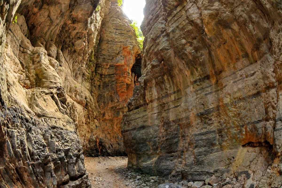
Gorges in Greece cut through Crete, the Peloponnese, Mount Olympus and the Ionian Islands. Small-group trips through Greece with a local host take place across these regions. Lepida on Mount Parnon, the Nedonas by Kalamata and Ziliana on Olympus are mainland examples. Poros sits on Cephalonia, while Myli, Astrakiano, Theriso, Ambas and Mesona lie on Crete. Related reading sits under Greece hiking tours, Waterfalls in Greece and national parks in Greece. Wider plans start at Greece tours.
Bookings made through the GetYourGuide widgets on this page earn Classical Greece Tours a commission, at no extra cost to the traveller.
Which are the gorges in Greece?
The gorges in Greece are deep clefts between cliffs or escarpments, which are long, steep slopes. Each one forms through weathering and river erosion over geologic time. Weathering means rock crumbling bit by bit under rain, frost, heat and wind.
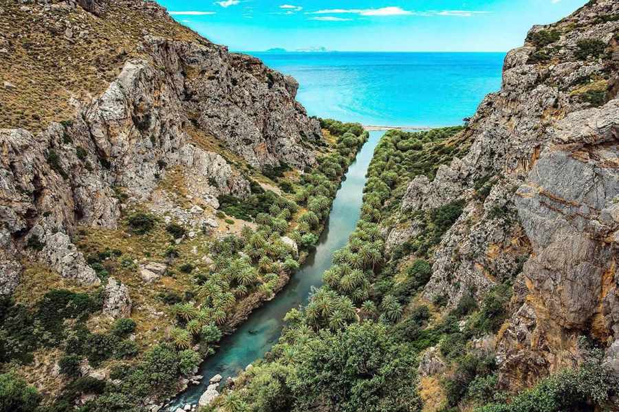
Water shaped the gorges in Greece over long ages. Rivers slowly wear away whole layers of rock, and the loose sediment travels downstream. A gorge takes shape where a river’s headwaters, or source, sit far higher than its estuary. An estuary is the wide mouth where a river meets the sea.
Frost also breaks rock apart. Water seeps into cracks, freezes and expands, pushing the rocks away from each other. This process is called frost wedging, and it splits large chunks from gorge walls. Limestone is another common setting, because the rock dissolves slowly in water. When a cave system inside limestone collapses, a canyon remains.
English names for the gorges in Greece use the word gorge. Gorge and ravine both come from French, and Europe favours them, while North America says canyon. A ravine is a narrow, steep-sided valley worn by running water. On Crete, the mountains hold plateaus, caves and gorges, among them the Samaria Gorge.
- Bearded vulture: This endangered bird of prey lives in the Cretan mountains and gorges.
- Chasm: A chasm is a deep opening in the ground, and the word also means gorge.
- Sediment: Sediment is the sand, mud and broken stone that flowing water carries along.
Gorges also divide mountain ranges. On the Taygetus range, the Rindomo Gorge cuts between the Central Range and Southern Taygetos. Such a range forms one long line of linked peaks. The Rindomo is one of the gorges in Greece that splits a range in two.
Which waterfalls run through Lepida, one of the gorges in Greece on Mount Parnon?
The gorges in Greece include Lepida, a natural formation of Mount Parnon. It lies in the Arcadia region of the Peloponnese. The gorge measures only 500 metres from end to end, yet it holds two waterfalls along its course.
In Lepida, one of the gorges in Greece fed by springs, the water starts on the Xirokabi plateau. Plateau means a broad stretch of level upland. This plateau sits between Malevi monastery and the village of Agios Ioannis. The monastery is named after Malevos, which is what locals call the summit of Parnon.
From the plateau, the river runs down towards the gorge. Along its course it forms little lakes, which are small pools of still water. The first waterfall lies 3 kilometres from the village of Agios Ioannis. Lepida also has a second, smaller waterfall called Melissi. That fall lies 1.5 kilometres from the village of Platanos.
The flow of water through Lepida stops during the summer months. Of the gorges in Greece, it is one that suits canyoning and rappelling excursions. Canyoning means travelling down a gorge by walking, climbing, swimming and sliding. Rappelling means lowering oneself down a rock face on a fixed rope.
- Main waterfall: The larger of the two Lepida waterfalls is 70 metres high.
- Oria castle: The old Oria castle is located near the Lepida Gorge in Arcadia.
- Malevi monastery: Malevi stands on the slopes of Mount Parnonas at an altitude of 900 metres.
Tradition dates the first monastery at Malevi to 717 AD. Malevi became a nunnery in 1949, a short way from one of the gorges in Greece. A nunnery is a house of nuns. Today the gorge and the convent share the slopes of Parnon.
Where does the Nedonas river carve one of the gorges in Greece?
The gorges in Greece include the steep, narrow gorge of the Nedonas. This river flows through the region of Messenia in the Peloponnese. It rises on the western slope of the Taygetus mountains, then runs south-west through its gorge towards Kalamata.
The river’s source lies at around 1,100 metres, near the village of Artemisia. That figure measures height over sea level. In katharevousa, a formal style of Greek once used in official writing, the river is called Nedon. Among the gorges in Greece, this one belongs to a river 22 kilometres long.
Rain over 146 square kilometres drains into the Nedonas. That stretch of land is its drainage area, also called a catchment. That area equals 56 square miles. Small tributaries feed the Nedonas, the river of one of the gorges in Greece, including the Nedousa. Tributaries are side streams that add their water to a bigger river.
Below the gorge, the Nedonas passes through the centre of Kalamata city. It then empties into the Messenian Gulf. A gulf is a deep bay, partly ringed by land. Greek National Road 82 runs beside the river for part of its length. That road links Pylos, Kalamata and Sparta.
- Kalamata: The city serves as both capital and main port of Messenia.
- Nedon River: Kalamata lies along the Nedon River, the formal name of the Nedonas.
- Gulf head: Kalamata stands where the Messenian Gulf reaches its innermost end.
Among Peloponnese cities, only Patras has more people than Kalamata. Kalamata is also the largest city of its administrative region. A region here has its own elected government. From the Taygetus slopes to the city centre, the Nedonas runs through one of the gorges in Greece.
What does the Ziliana gorge add to the gorges in Greece around Mount Olympus?
The gorges in Greece around Mount Olympus include the great gorge of Ziliana. It lies on the southern foothills of the mountain and runs for a length of 13 kilometres. The gorge forms a natural limit that separates Olympus from Lower Olympus.
Among the gorges in Greece, Ziliana holds Kanalon Monastery at an altitude of 820 metres. It lies 8 kilometres east of the village of Karya, above the Ziliana river. Forest surrounds the buildings on every side. Today it is a convent, a religious house of nuns. It has worked again in that role since 2001.
The monastery is named after four wild brooks nearby, called kanalia, which means channels. These brooks join to form the Ziliana river. Tradition says the monks Damian and Joachim founded this house among the gorges in Greece in 1055. The 19th-century French traveller Léon Heuzey instead dated its foundation to the ninth century.
A 1638 inscription, painted with the frescoes in the chapel of All Saints, is its first written record. Frescoes are wall paintings laid onto damp plaster. In 1881 the katholikon, or main church, collapsed for unknown reasons. Builders raised it again two years later on the old foundations. The house stood empty from 1930.
- Masonry: The masonry of the katholikon is locally quarried stone and marble.
- Leibethra: Leibethra, an ancient Macedonian city, stood at the base of Mount Olympus.
- Two rivers: The Griva and Kavourolaka rivers border its acropolis and flow into the Ziliana.
Kanalon lies about 7 kilometres in a straight line from ancient Leibethra. An acropolis is a walled hilltop citadel, the upper town of a Greek city. At Leibethra it rises to 130 metres, close to one of the gorges in Greece on Olympus.
Which legends belong to the Poros gorge, one of the island gorges in Greece?
The gorges in Greece reach the Ionian Islands at Poros, a small town in the south-east of Cephalonia. Upstream of the town, the Vohinas river flows out of the Poros gorge. This rugged ravine, 80 metres deep, counts among the island gorges in Greece.
The name Poros almost surely comes from the Vohinas. In Greek, poros means a ford or crossing, a shallow place to cross a river. The river mouth is the only natural crossing point. A road to Skala was cut around 1996. Before then, the only land route out of Poros ran through one of the gorges in Greece.
Local legend says Heracles cut the gorge. He stood on the mountain and flattened it. Heracles is a strong hero of Greek myth. Finds from the Drakaina cave in the gorge date human life at Poros to 5,700 BC. Stone and bone tools, figurines and pottery came to light there.
Classical finds link the cave with the cult of the Nymphs. A cult here means worship paid to a god or spirit. Nymphs were nature spirits of Greek myth. The name Drakena means She-Dragon, after a local tale of a dragon living in the gorge. Marks in the rock walls were once taken for the dragon’s footprints.
- Bridges: Two bridges now cross the Vohinas upstream, where the river leaves the gorge.
- Atros monastery: Just out of the gorge, a rough track leads to Atros, the oldest monastery on Cephalonia.
- Argostoli museum: The Archaeological Museum of Argostoli shows the major finds from the Tzanata tomb.
In 1991, a tholos tomb came to light at nearby Tzanata. Tzanata lies in a fertile valley beyond one of the gorges in Greece. A tholos is a beehive-shaped stone tomb. Its finds include golden bull horns and a golden double axe.
What remains in the Myli gorge, one of the Cretan gorges in Greece?
The gorges in Greece include the gorge of Myli on Crete, near the village of Chromonastiri in Rethymno. Myli, also spelled Myloi or Mili, takes its name from the water mills that once worked there. Such mills ground grain with the power of moving water.
Myli names three settlements. A new village from the early 1970s is called new Myli. Two deserted villages, Ano Myli and Kato Myli, lie within one of the gorges in Greece. Ano and kato are the Greek words for upper and lower. Its people left the Venetian village for unknown reasons over a century ago.
References show people lived in the Myli area from Ottoman times onwards. Yet buildings and remains from the Venetian period also survive. The word Venetian refers to the old state of Venice. Among the gorges in Greece, Myli runs from Chromonastiri to the hamlet of Xiro Chorio. A small river runs along its floor.
The deserted old village still shows traditional buildings, old churches and caves. The gorge also leads to the Byzantine chapel of Saint Anthony. The word Byzantine points to the art and age of the eastern Roman empire. Chapels are small churches. The village has abundant vegetation, meaning thick plant life.
- Xiro Chorio: The name joins two Greek words, xiro for dry and chorio for village.
- Hamlet: Xiro Chorio, where one of the gorges in Greece ends, is a hamlet of about 170 residents.
- Saint Mark: Its chapel of Saint Mark is one of only two on Crete honouring that saint.
Where the gorge starts, Chromonastiri keeps Villa Clodio, once a summer home of Venetian nobles from Rethymno. The restored mansion now houses the Military Museum. Mansion means a big, stately home. The museum holds military uniforms, weapons and decorations.
Which bridge spans Astrakiano, one of the gorges in Greece near Heraklion?
The gorges in Greece near Heraklion include Astrakiano, a gorge on Crete. The village of Astraki gave the gorge its name. The gorge starts near the village of Peza and runs for about 12.5 kilometres towards the north.
Astrakiano belongs to a larger geological complex called the Juktas ecopark. An ecopark is a protected natural area. Mount Juktas rises to 811 metres south of Heraklion, above the town of Archanes. Astrakiano and its neighbour Kounaviano are two of the gorges in Greece that run side by side.
The Karteros river flows through the gorge. Among the gorges in Greece, Astrakiano has lush vegetation of fig trees, kermes oaks, willows and plane trees. A kermes oak is a small, evergreen, prickly oak of the Mediterranean. Willows are trees that grow beside water, with long, thin leaves.
Near the abandoned village of Kato Astraki, a stone arch bridge spans the gorge. It is known as Astrakiani Kamara and dates from the early 20th century. Kamara is a Greek word for an arch. The Neraidospilios cave and a small pond lie a short distance away. Its name means the cave of the fairies.
- Kounaviano: The neighbouring Kounaviano gorge runs about 8 kilometres and takes its name from Kounavi.
- Kaki Rachi: At Kaki Rachi, near Skalani, the pair join and form the Karteros gorge.
- Watermills: Around 10 watermills worked along Astrakiano before the Second World War.
Every one of those watermills now stands abandoned. Mount Juktas held one of the leading peak sanctuaries of the Minoan world, possibly the first. A peak sanctuary is a holy site on a mountain summit. Its name now marks the ecopark around these gorges in Greece.
Which 1905 revolt took its name from Theriso, above one of the gorges in Greece?
The gorges in Greece include the Theriso gorge, south of Chania on Crete. The village of Theriso sits at its top. In March 1905, a revolt against the government of Crete broke out there and took the village’s name.
At that time, Crete was an autonomous state under the suzerainty of the Ottomans. Autonomous means self-governing, and suzerainty means overlordship by a stronger state. Eleftherios Venizelos, a Cretan politician, led the uprising. He chose the village for its strategic position. It lies 14 kilometres from Chania, at the top of one of the gorges in Greece.
Narrow gorges guarded the passage toward Theriso, and the insurgents found them easy to control. An insurgent is a person who rises in arms against a government. These gorges in Greece hid grottoes and caverns, which gave the rebels natural shelter. Grottoes are small caves, while caverns are large ones.
Around 1,500 Cretans later met at Theriso. From then on, the village served as the centre of the revolt. The gathering took place at the Church of Saint George in Theriso. Two chief counsellors of Prince George, the island’s ruler, later resigned and joined Venizelos in the mountains.
- Winter: Winter’s arrival made life harder for the rebels who hid in the mountains.
- Amnesty: The rebel camp at Theriso closed on 25 November, and an amnesty followed.
- Reputation: After the revolt, Venizelos stood as the leading politician on Crete.
An amnesty is an official pardon for a group of people. In 1909, that reputation led Greece to call him, and he became its Prime Minister. His mother’s village, at the head of one of the gorges in Greece, gave the revolt its name.
Who gave Ambas its name among the gorges in Greece?
The gorges in Greece include Ambas, a natural formation in the Asterousia Mountains of southern Crete. Heraklion lies about 50 kilometres to its north. Its name comes from the Latin word abbas, which means abbot, the leader of a community of monks.
The name points to hermit monks who once lived alone in the Asterousia Mountains. Hermits are people who withdraw from society to pray in solitude. The range keeps the Messara Plain apart from the coast of the Libyan Sea. Its highest peak, Kofinas, reaches 1,231 metres, so the range is also called the Kofinos Range.
The Mousoulis stream carves the gorge. It drains water from Paranymfi and Amygdalos at around 700 metres. The stream crosses the plateau, then plunges down the rocky Asterousia fault line. At a fault line, blocks of the crust have shifted. That plunge creates the Ambas waterfall, one of the high falls among the gorges in Greece.
The waterfall forms where smooth plateau suddenly gives way to rugged cliff. Below it, the gorge keeps falling towards the sea through a series of smaller waterfalls. Among the gorges in Greece, Ambas holds 21 rappels, and the tallest measures 45 metres. Each rappel is a drop made by sliding down a fixed rope.
- Four sections: The main Ambas waterfall divides into four free-hanging sections on its way down.
- Watermill: Just above the waterfall, beside a parking area, lie the ruins of an old watermill.
- Birds of prey: Europe’s largest island-based group of birds of prey lives on the cliffs of the wider Asterousia region.
Digs inside the range have turned up traces of early Cretan peoples. To the north stands Phaistos, a major Minoan site. Its palace appears designed to look over the Messara Plain and the Asterousia range. Ambas belongs to the southern gorges in Greece on Crete.
How did runoff shape Mesona and the other Thrypti gorges in Greece?
The gorges in Greece include Mesona, a relatively small canyon in Ierapetra on eastern Crete. It lies to the east of Kavoussi village, just beyond the church of Agia Kyriaki. The gorge runs for up to 4 kilometres in length.
Among the gorges in Greece, Mesona links the Thripti plateau with the area of Kavoussi. Thripti, also spelled Thrypti, is a mountain range in Lasithi. In its last part, the canyon changes shape abruptly. It grows narrower, and tall rock walls close in. Only a small amount of water flows through it in winter.
A cement aqueduct runs along the west side of the gorge. An aqueduct is a channel built to carry water. Across the Thrypti massif, runoff has cut these gorges in Greece deep into its edges. Runoff means rainwater running across the surface rather than sinking in. Limestone is soft and dissolves in water, which helps the cutting.
Seen from outside, the Thrypti massif looks like a wall of mountains. The word massif names a solid mass of high ground. On top, gentle slopes and plateaus support pastures, farming and villages. It is too dry up there for much greenery, and bare rocky slopes are the norm. Caves and deep cuts are common across the massif.
- West Sitia Mountains: Thrypti, the Ornon range and the Western Siteia Foothills form the West Sitia Mountains.
- Bebonas valley: The Bebonas river valley separates the Thrypti range from the Ornon mountains.
- Ierapetra: The Thrypti mountains lie almost entirely within the municipality of Ierapetra.
The range trends north-east from Ierapetra towards Sitia, yet reaches only half way. Its length is about 20 kilometres, and its width reaches about 9 kilometres. Mesona is one of the gorges in Greece cut into this mountain range.
What do travellers ask about gorges in Greece, and what are the answers?
Gorges in Greece reach from Macedonia in the north to Crete in the south. The Rentina Gorge lies just outside Thessaloniki, while the Fonissa stream cuts a narrow gorge in Corinthia. On Crete, Milona Gorge sits near Ierapetra, and Kritsa Gorge lies west of Agios Nikolaos.
Which of the gorges in Greece is called the Macedonian Tempe?
The Rentina Gorge carries the name Macedonian Tempe. The name borrows from Tempe in Thessaly, a long belt of rivers, hills and gorges. In modern speech, Tempe is pronounced Tembi. Rentina sits close to Thessaloniki, with Mount Cholomon on one side and the Kerdylia range on the other.
Near Ierapetra, which waterfall ends one of the gorges in Greece?
Milona Gorge lies near the village of Agios Ioannis, in the municipality of Ierapetra on Crete. A large waterfall waits at the end of the walking path. At that point, the fall of Milona is 40 metres high. Municipality means a district run by its own town council.
How narrow is Kritsa, one of the gorges in Greece near Agios Nikolaos?
Kritsa Gorge is a tight, narrow cleft close to Kritsa village, west of Agios Nikolaos on Crete. In Greek it is called Faragi Kritsas, and faragi means gorge. Along its course, narrow passages squeeze between walls of rock. A passage here is a gap wide enough to pass through.
Before a trip to Corinthia, what is the Fonissa among the gorges in Greece?
The Fonissa is a stream in western Corinthia, in the Peloponnese, 13.3 kilometres long. It rises in the hills near the village of Rethi. From there it flows south-east through a narrow gorge. It meets the Gulf of Corinth between Kato Loutro and Kamari, 6 kilometres north-west of Xylokastro.